
The River Graveney is a tributary of the River Wandle. It starts as Norbury Brook but turns into the River Graveney as it runs through Streatham and Tooting. In total, the River Graveney runs for 5.9 miles, mostly underground.
This post is about the history of the River Graveney and includes a map showing the river’s path.

River Graveney Map
The map below shows the path of the River Graveney. The dark dotted line on the map is where the river runs underground. You can see once the river enters Tooting it meets with the River Wandle.
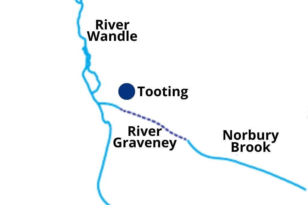
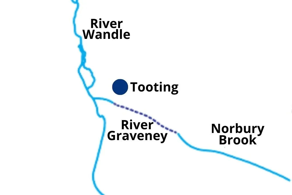
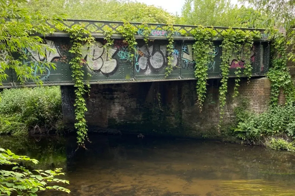
You can see from the map below that the River Graveney meets with the River Wandle just north of the Wandle Meadow Nature Park. This part of the river is entirely artificial, as old Ordnance maps show the river meandering close to the Wandle, but not actually joining it for another mile in Summerstown.

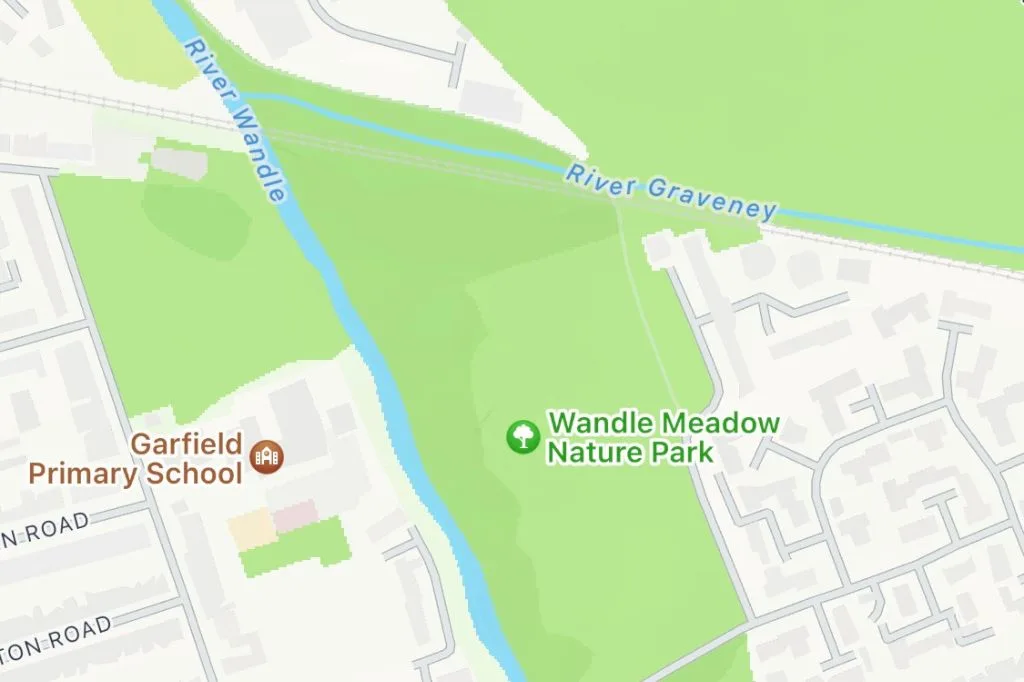
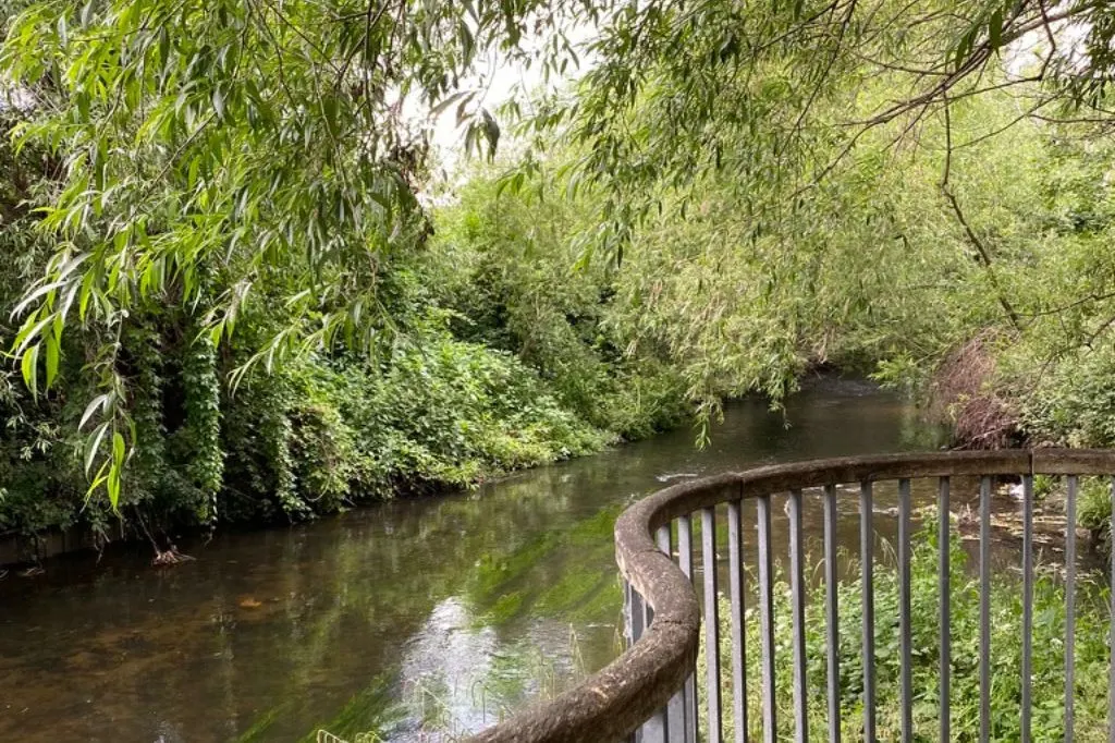
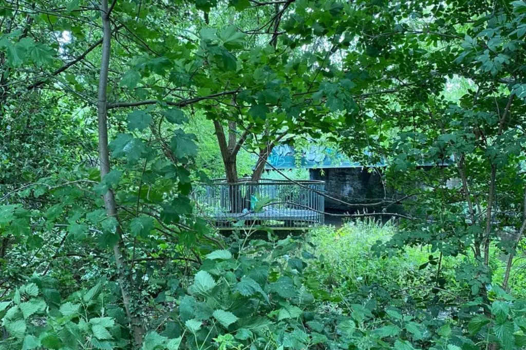
The place where the Wandle and Graveney meet is marked by a viewing platform along the Wandle Trail. The metal viewing platform (shown in the photograph below) is close to the railway bridge that you can see on the map.

History of the River Graveney
In the Domesday Book, Tooting was divided into two manors. The southerly of the two was Tooting Graveney.
The name “Graveney” comes from the De Gravenel family who owned large pieces of land in the area in the 12-13th century. The River Graveney was named after the parish that it flowed through.
The Graveney is a small stream, which unlike the Wandle, was not powerful enough to support any water mills. Instead it was used in history as irrigation for crops, and to wash away waste.

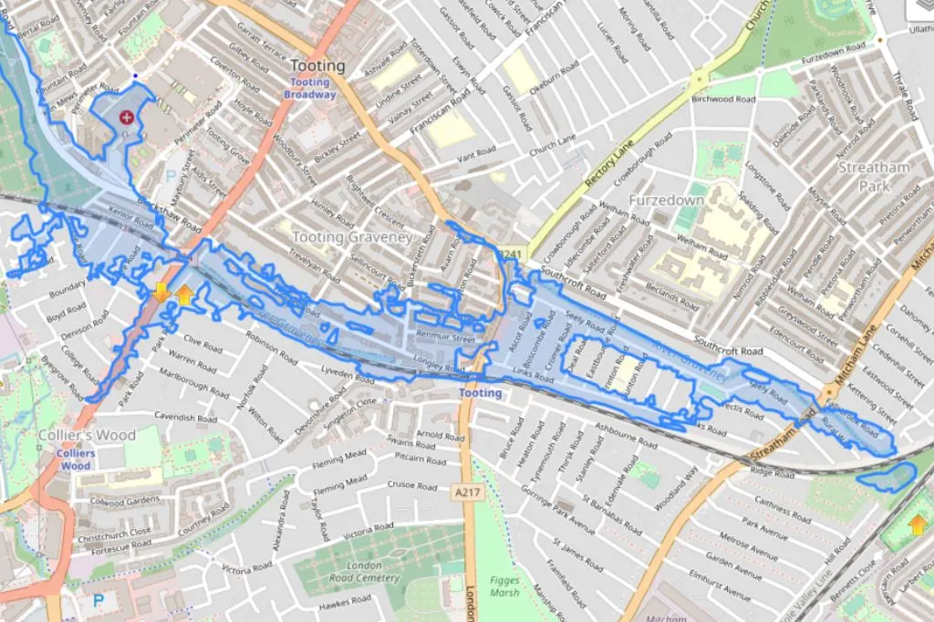
River Graveney Flooding
The River Graveney is monitored regularly for risk of flooding, since the Environment Agency identified around seven hundred properties, including private houses, which were at risk.
The area that is coloured blue in the map below shows the region that is covered by flood alerts for the River Graveney.

Matthew Marks
Monday 10th of April 2023
As far as I know, the Graveney splits where High Street Colliers Wood crosses the railway, where you can see it entering a culvert in the pocket park on the corner of Robinson Road, then down the east side of the High Street (where it used to be in the open air), then along Byegrove Road before joining the section of the Wandle that has exited Wandle Park.
Paul Dear
Friday 10th of February 2023
The river then briefly reappears on the corner of Roninson rd, then crosses Colliers Wood high st into Waterfall rd and then follows the railway to the Wandle. There also used to be a culvert that ran along the far end of Mead Path (beside the cemetery) to Plough lane where the Plough pub used to be.
Geoff Boxell
Wednesday 22nd of March 2023
@Paul Dear, The "Leet" then was piped under the junction of Plough Lane and Summerstown. It ran under the then off licence (you could access it via a man hole in the cellar) and it then reappeared in teh car park of Wimbledon Stadium: originally it was the boundary between the then car park and the gardens of the clapboard mill houses in Summerstown before they were demolished and the car park extended. Going by what has been said in the article, the Leet may in fact follow the original course of the Gaveney.
Paul Dear
Friday 10th of February 2023
Running parallel to Southcroft is Sealey rd and near the junction of Mitcham rd is another jump in the road where the Graveney turns left and then right behind the houses of Longley rd.
Paul Dear
Friday 10th of February 2023
The Graveney crosses Mitcham lane and runs down behind the houses on Southcroft rd. Halfway down Southcroft rd, if you turn left into Eastbourne rd there is a humped bridge where you can look over the wall and see the river.
David Bevan
Sunday 15th of January 2023
The culverted Graveney that crosses the Thameslink tracks at the western end of Robinson Road (where it can be viewed through the fence) and then travels alongside the northern side of the railway until it submerges under Mitcham Road may constitute a flood risk, but in practice seems to be a fairly effective flood defence. I do recall (within the last twenty years) flooding of the railway line confined to the western side of the Colliers Wood High Street bridge, which did not penetrate below the bridge to the east, presumably because the culvert system prevented it doing so.