
The River Effra is south London’s main lost river. It once flowed from West Norwood and Dulwich, through Herne Hill, Brixton and Kennington to Vauxhall where it met with the River Thames.
Today it is buried underground, and used as part of London’s sewer system. Despite this however, it is still possible to walk the original course of the River Effra, and see signs of its influence on our environment.
There are two main branches of the River Effra: the lower Norwood branch and the upper Norwood branch. This self-guided walk follows the course of the lower branch of the river.

During this walk you will see how the local area has been shaped by the River Effra, which formed natural valleys in our landscape. The route is also marked by Victorian stink pipes, that were built to allow gases, from the sewer pipes beneath, to escape into the atmosphere.
You will also see many gardens and parks along the walking route, which were designed to absorb rainwater to reduce the risk of the Effra flooding.
Even though the Effra is now entombed below our streets, it still floods during storms when the sewers cannot cope with the extra water.
River Effra Walk
The River Effra has two sources. One of them starts in the area of Westow Park in Croydon, and the other starts the other side of Crystal Palace Station. The steep hill between is actually the ridge produced by those two branches of the river.
River Effra Map
The map below shows the approximate route of the River Effra itself, rather than the route of the walk. The route of the walk can be found below, along with maps for each section.
River Effra Self Guided Walk
You can click on the links below to jump to a specific point in the walk.
- 1. Westow Park
- 2. Upper Norwood Recreation Ground
- 3. Hermitage Road
- 4. Church of Virgo Fidelis
- 5. Norwood Park
- 6. Gypsy Road
- 7. East Place
- 8. Dunelm Grove
- 9. West Norwood Cemetery
- 10. Robson Road
- 11. Dalmore Road
- 12. Croxted Road
- 13. Burbage Road
- 14. Dulwich Road
- 15. Dalberg Road
- 16. Effra Hall
- 17. Brixton Market
- 18. Brixton Police Station
- 19. Brixton Road
- 20. Prima Road
- 21. The Oval
- 22. River Effra Storm Channel
1. Westow Park
The walk starts in Westow Park. This is the source of the lower branch of the River Effra. You can see from the map below that the river still flows beneath the park.


As you walk through Westow Park, you can clearly see from the landscape that you are descending into a river valley. The steep slope of the park was the river’s headwater.


After you leave Westow Park, turn right onto College Green, left onto Harold Road, and then turn into Chevening Road.
2. Upper Norwood Recreation Ground
The river flows along the side of Upper Norwood Recreation Ground, under the houses of Chevening Road.


The river was above ground in this location until the early 19th century when it became part of London’s sewer system.
Once you reach the end of Chevening Road, turn right onto Hermitage Road.
3. Hermitage Road
You can see from the map below that the river flows underneath Hermitage road. This is clearly evident from the landscape of the road.


At this point in the walk you will have to divert from the original course of the river, since Priory School stands in the place where the river once flowed.
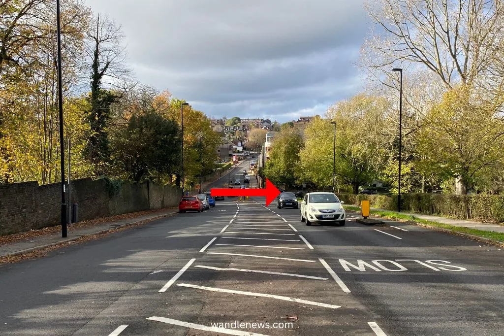
The photograph below was taken from the end of Hermitage Road, looking back from where it meets Central Hill. You can clearly see the dip in the road which marks the river valley. The red arrow shows the direction the river was flowing.


Once you reach the end of Hermitage Road, turn left onto Central Hill.
4. Church of Virgo Fidelis
After turning onto Central Hill, you will pass the old Victorian Convent which was founded in 1857. At the time, the River Effra flowed behind the convent, and formed a pond in its grounds. The building was used as a Catholic orphanage for victims of the potato famine.


You can see from the map below that the River Effra flowed behind the Virgo Fidelis convent, and formed a pond in a gravel pit. After the river flows out of the convent grounds it passes under Central Hill. This point of the River Effra frequently flooded if there was heavy rain.


The photograph below shows the view looking down Central Hill after you pass the convent. You can see the road sloping down to what was once the bottom of the river valley. The direction of the river is marked with a red arrow.

After you have passed the convent you will see Norwood Park on your right. Turn right down Elder Road.
5. Norwood Park
Today the River Effra flows under Norwood Park, but it once marked an ancient boundary when this land was an open space used for grazing. Norwood Park is today just a fragment of what was once the Great North Wood, which was owned by the Archbishops of Canterbury and covered over 1,400 acres of land.
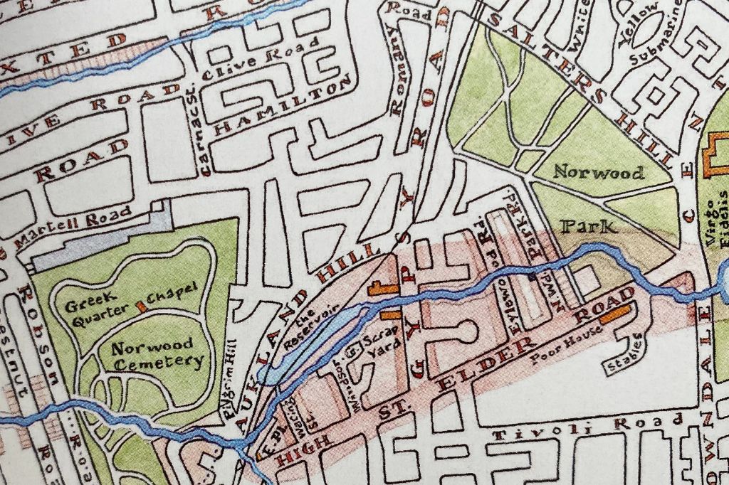
You can see from the map below that after the river leaves the park, it flows under the houses on Norwood Park Road, Eylewood Road and Gipsy Road.

As you walk down Elder Road you will see the former Lambeth Children’s Workhouse on your left. The workhouse was frequently flooded by the River Effra, and was a health hazard to the children due to the levels of pollution in the water.
Turn right onto Gypsy Road.
6. Gypsy Road
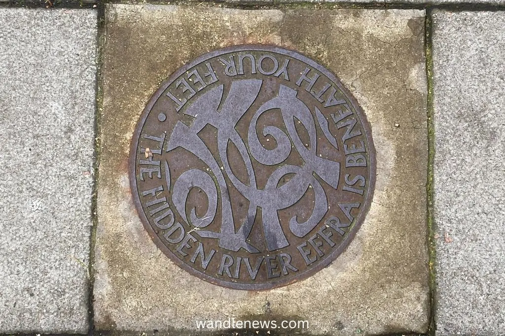
On Gypsy Road you can see the path of the river which is shown by a clear dip in the road. There is also a stink pipe here, which was built in 1863 at the lowest point on Gypsy Road, as well as a plaque marking the route of the River Effra.

The plaque can be found next to the stink pipe, and is shown in the photograph below. The words on the plaque says: “The Hidden River Effra is Beneath Your Feet.”


You can see on the map below that the railway line from that travels between West Norwood and Gipsy Hill stations follows the river valley. The railway line was built in 1857, the same year that this part of the River Effra was buried underground.


Turn left onto Auckland Hill. Walk down Auckland Hill and turn left onto Pilgrim Hill.
7. East Place
Once you are on Pilgrim Hill you will see East Place on your left. This is a part of the Effra that flooded in 1914 when the sewers bubbled up. It is at this point where the River Effra meets with one of its smaller tributaries, which makes it a vulnerable spot for flooding.


Return to Auckland Hill and you will see a fork in the road. Turn right down Dunelm Grove.
8. Dunelm Grove
The course of the river crossed Auckland Hill and goes under a part of Dunelm Grove before it cuts through Norwood Cemetery.

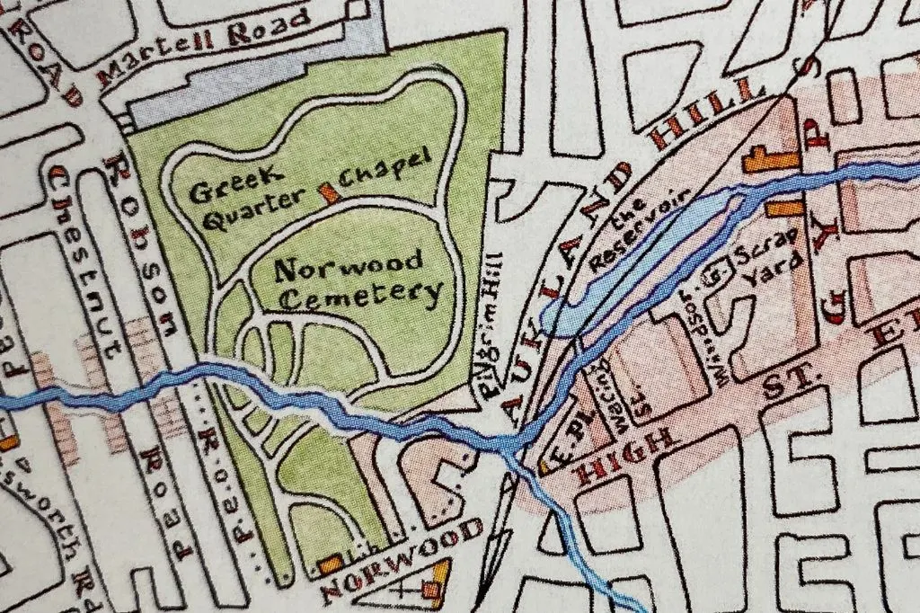
You can walk through Dunelm Grove and onto Norwood High Street where you will pass St Luke’s Church.


Walk along Dunelm Grove until you come out onto Norwood High Street. Turn right and you will soon see the entrance to West Norwood Cemetery.
9. West Norwood Cemetery
West Norwood Cemetery is one of the Magnificent Seven cemeteries in London. The other six include Kensal Green Cemetey, Highgate Cemetery, Abney Park Cemetery, Brompton Cemetery, Tower Hamlets Cemetery, and Nunhead Cemetery.


Today the River Effra passes under part of the cemetery, but when the South Metropolitan Cemetery Company first acquired the land in 1836, the River Effra still flowed through it. At the time it was a polluted river with a tendency to flood, so the company soon covered it up.
The two entrances to Norwood Cemetery are both on Norwood High Street. Once you come out of the cemetery, turn right onto Robson Road.
10. Robson Road
On Robson Road you will find four stink pipes next to the Cemetery wall which mark the points where the river left the cemetery.


After the River Effra leaves Norwood Cemetery, it flows under the houses on nearby roads including Hexham Road, Lavendro Road, Tulsemere Road and Dalmore Road. The river’s path is shown in the map below. These roads were once all water meadows.
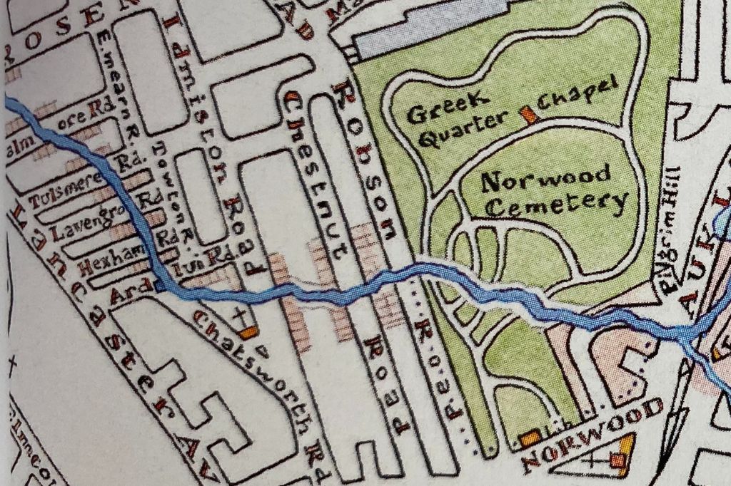

Walk down Robson Road, turn left onto Chestnut Road, right onto Barston Road, right onto Idmiston Road, right onto Tulsemere Road, right onto Lancaster Avenue until you reach Thurlow Park Road.
11. Dalmore Road
As you are walking down Thurlow Park Road, if you look to your right you can see you are looking down into a river valley. The photograph below shows the view of Dalmore Road from Thurlow Park Road, with a red arrow marking the direction of the River Effra.


Keep walking down Thurlow Park Road until you meet the junction with Croxted Road.
12. Croxted Road
The junction of Croxted Road and Thurlow Park Road is where the upper and lower Norwood branches of the River Effra meet. You can see on the map below that the rivers meet in the centre of Thurlow Park Road just before the junction with Croxted Road. The river then cuts across Turney Road and Dulwich sports ground.

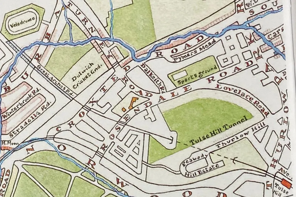
The part of the River Effra that flows down Croxted Road was the last part of the river to be covered over in the nineteenth century.
The small tributary you can see in the map below near Turney Road, was named “The Turney” and is where Turney Road got its name. The other was “The Ambrook” which came from Sydenham Hill, and was joined by a stream that came from the lake in Belair Park.


Turn left down Croxted Road, turn right onto Turney Road, turn left onto Burbage Road.
13. Burbage Road
The River Effra then crossed Burbage Road, and under the railway lines on Great Arches Road.
Burbage road is named after the Shakespearian actor Richard Burbage, and you will find a mural of him under the railway bridge.
It is not clear why the road was named after Richard Burbage, but it may have been at the suggestion of Dulwich College, which was was founded by the Shakespearian actor Edward Alleyn.


In the past, this part of the River Effra went by a different name, and was known as “The Winterbrook”. Today you will find a nearby road, off Burbage road named Winterbrook Road.


Walk to the end of Burbage Road. Turn left onto Half Moon Lane. Walk past Herne Hill Station and onto Dulwich Road.
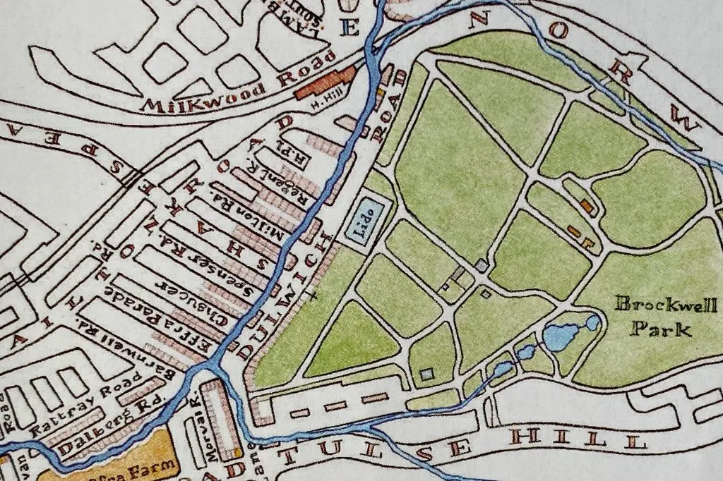
14. Dulwich Road
The River Effra flows behind the houses on Dulwich Road, as shown on the map below. Dulwich Road was once known as Water Lane, and went through a gap in the hills through which the Effra had to flow.
You can still see the hills on either side of the road. On your left is the steep slope of Brockwell Park as it climbs up Knights Hill, and on your right are the heights of Herne Hill.

As you walk down Dulwich Road you will see a green Victorian stink pipe which marks the course of the former river. Next to the stink pipe is a plaque with information about the Lost Effra Project which encourages local people to make small changes to their gardens to help reduce the risk of flooding.

Just past the stink pipe you will see the Prince Regent pub. The pub was first built in the 1830s and was originally accessed by a small wooden footbridge over the River Effra.


Before you reach the end of Dulwich Road you will see Effra Parade on your right. Unlike Effra Road, which was named after the old Effra Farm, Effra Parade was named after the river that flows beneath its street.
The end of Dulwich Road, where it meets Brixton Water Lane, was the place where the River Effra met with one of its tributaries, before flowing along the path of Dalberg Road.
At the end of Dulwich Road, turn right onto Barnwell Road and left onto Dalberg Road.
15. Dalberg Road
Dalberg Road was once the site of the old Effra Farm, which is where the river got its name. Effra Road, which you can see in the map below was also named after the farm.


At the end of Dalberg Road turn right onto Mervan Road. Turn left onto Rattray Road.
16. Effra Hall
On the corner of Rattray Road and Mervan Road you will find an Effra plaque on the ground. When you get to the next junction with Kellett Road you will find a pub called the Effra Hall.
Effra Hall was originally the name of an attractive, detached villa located within the Effra Farm Estate. Effra Hall once stood opposite St Matthew’s Church on Effra Road, at the end of what is now Kellet Road.
When the former Effra Hall was demolished in the nineteenth century, a new pub was built close by, and named after the original villa. The Effra Hall pub today stands on the site where the River Effra once flowed through the grounds of the Effra Farm estate.


After this point in the walk, the river runs below the houses on Saltoun Road and through central Brixton.
Turn left onto Saltoun Road, right onto Effra Road, right onto Coldharbour Lane, left onto Electric Lane.


17. Brixton Market
The River Effra flows directly underneath Brixton market. You can follow its course by walking down Electric Lane, turning right onto Electric Avenue, continuing straight onto Pope’s Road.


Turn right onto Electric Avenue. Follow the road onto Pope’s Road and Canterbury Crescent.
18. Brixton Police Station
Outside Brixton Police Station you will see a line of River Effra plaques showing the former course of the river. Each plaque has a different image on it representing the flow of water, and contains the inscription: The Hidden River Effra is Beneath Your Feet.


19. Brixton Road
After the police station, the River Effra flows in a straight line down Brixton Road. You can see the houses on the right side of the road are set back from the main road by a long distance. This is because the River Effra once flowed in this space.
In the early nineteenth century, residents campaigned to have this part of the river covered over, so they would have access to the main road. It was also heavily polluted and a health hazard to the local area.
The Effra was eventually covered over in this spot in 1847, but signs of it can be seen along the full length of Brixton Road. The large space between the houses and the main road indicate the path of the river.
The photograph below shows an extra roadway along Brixton Road, that you will pass just after the police station. This extra space is where the River Effra once flowed.


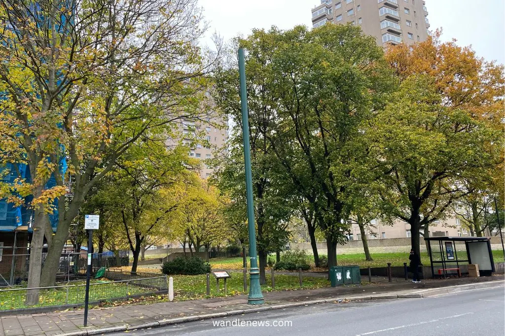
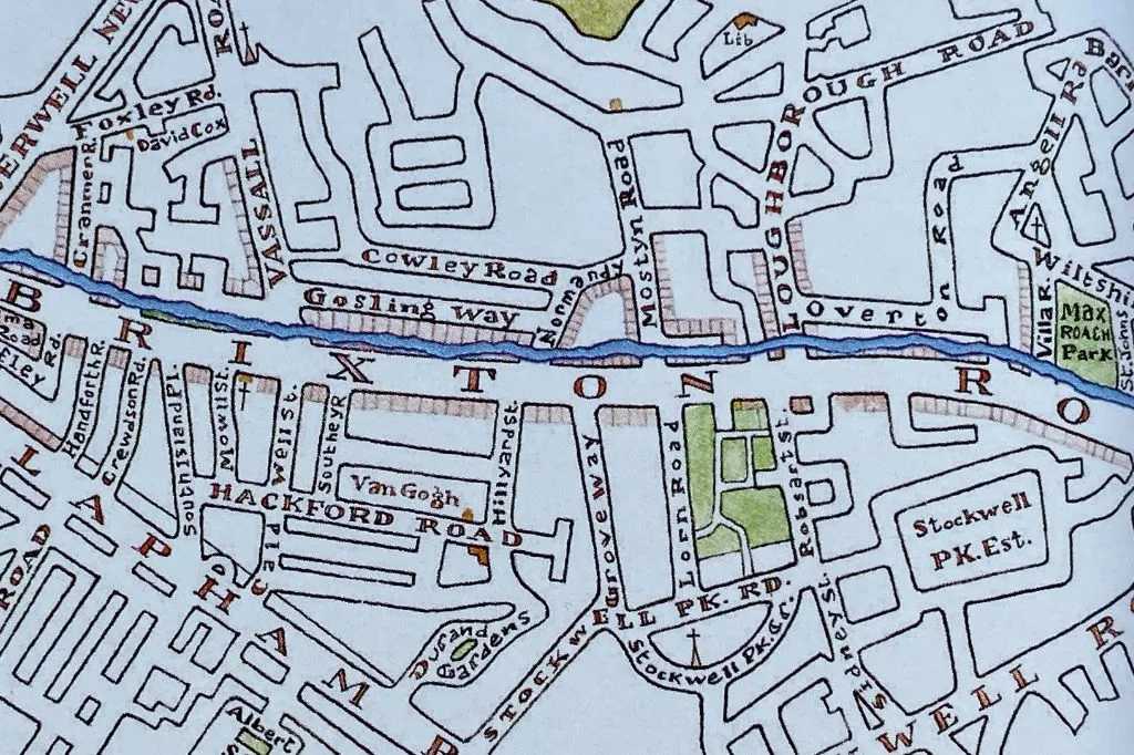
As you walk along Brixton Road you will see large spaces of parkland between Villa Road and Loughborough Road where the River Effra once flowed.
You will also see the terraced houses between Normandy Road and Vassall Road are set far back from the main road, and have long extended front gardens. This is because at the time when these houses were built, the River Effra flowed in front of them.

Walk down Brixton Road and turn left onto Prima Road just before you get to Kennington Park.
20. Prima Road
As you turn into Prima Road you will see St Mark’s Church on your right. The road follows the exact path of the River Effra, which curved round towards the Thames.


As you walk down Prima Road you will see a grassy area to your right. This is now St Mark’s church and grounds, but was once the site of the Kennington Gallows. The last execution took place here in 1799, and the church was built twenty five years later.
The photograph below shows the view looking down Prima Road, with St Mark’s church on the left. In the 18th century, Prima Road was the course of the Effra, with public executions taking place next to it.


After leaving Prima Road, the river flows under Clapham Road, over the top of the Northern line, and then under a private estate. You will need to divert away from the course of the river at this point.
At the end of Prima Road cross over Clapham Road, and walk down Elias Place. Turn left onto Claylands Place, turn right into Claylands Road. At the end of Claylands Road walk through the Ashmole Estate to reach Harleyford Road and turn left.
21. The Oval
You can see from the map below that the curve of The Oval cricket ground was influenced by the original curve of the River Effra. Since Vauxhall has become so built up, it is hard to follow the exact course of the river at this point.
Before you turned into the Ashmole Estate you will have walked closed to a catholic care home called St Peter’s Residences. This was once the site of a mansion and pleasure gardens acquired by The Little Sisters of the Poor in 1861. For many years the River Effra flowed through its grounds.


Although the map above shows that the Effra meets with the River Thames in between Vauxhall Bridge and Nine Elms Lane, you will actually find the River Effra Storm Channel on the other side of Vauxhall Bridge, next to MI6.
22. River Effra Storm Channel
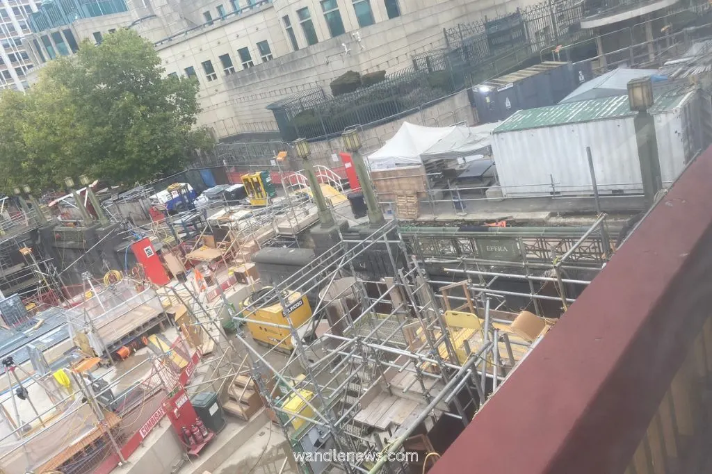
In the photograph below you can see the point where the River Effra meets the Thames. The construction work you can see in the picture is for the Thames Tideway Tunnel which is currently being built.
The Thames Tideway Tunnel will stop sewage from being dumped into the Thames, and take it instead to sewage to a treatment plant at Beckton.

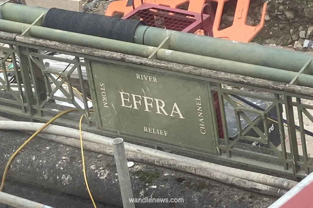
The photograph below shows the sign that you can see above the construction work showing where the River Effra met with the River Thames.

What Does Effra mean?
According to Jon Newman’s book River Effra – South London’s Secret Spine, the name “Effra” is probably a corruption of the name “Hethdron” or “Hetherowe”, which is a sixteenth century spelling of “Heathrow”.
The old Effra Farm was once part of the old Manor of Heathrow, which disappeared in the seventeenth century. It’s possible that the name “Effra” was drawn from various sixteenth century spellings of the world “Heathrow”.
River Effra Myths
There is a myth that Queen Elizabeth I would visit Sir Walter Raleigh at his house on Brixton Hill by sailing up the River Effra in her royal barge.
Different versions of this story have been repeated over the centuries but the tale is unlikely to be true, since it would have been difficult to sail any kind of barge from the Thames up the Effra.
There is another myth that King Canute sailed down the River Effra in 1016 in an attempt to capture Saxon London.
This again would have been impossible, as the River Effra would not have been wide enough for long ships to sail down it.
Practical Information for Your River Effra Walk
Below you will find the best guidebooks for following the River Effra, as well as information about where you can find toilets along the route.
Are There Toilets Along the River Effra Walk?
Large parts of the walk goes through residential areas where there are no public toilets. There are however toilets at certain points once you reach Norwood High Street and head towards Brixton.
Toilets can be found at the below locations. Please note any business listed below agrees that the public can use their toilet without having to buy anything as part of the Community Toilet Scheme.
- Little Rock Cafe, 130 Norwood High St, Norwood, London SE27 9NH
- Elas Cafe, 93 Norwood High St, Norwood, London SE27 9JS
- West Norwood Picturehouse, 1-7 Norwood High St, Norwood, London SE27 9JU
- Herne Hill Train Station, London SE24 0JW
- Brockwell Park, Norwood Road, Herne Hill, SE24 9BJ
- Brixton Pound Cafe, 77 Atlantic Rd, London SW9 8PU
- Brixton Market Toilets, 24A Pope’s Rd, London SW9 8JH
- Tesco Express, 330 Brixton Rd, London SW9 7AA
- Oval Tandoori, 64a Brixton Rd, London SW9 6BP


Guidebooks for Walking London’s Lost Rivers
I hope you love the guidebooks I recommend! Just so you know, these are affiliate links, so I will receive a small commission (at no extra cost to you) if you buy through the links. This commission helps me to cover the costs of running the website for which I’m very grateful.
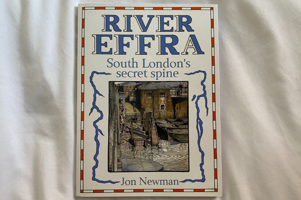
If you are interested in the River Effra my top recommendation is Jon Newman’s book called “River Effra South London’s Secret Spine“.

Other Recommendations:
- Ben Aaronovitch Rivers of London (not a guidebook but a great read!)
- London’s Lost Rivers: A Walker’s Guide
- London’s Lost Rivers
- London’s Hidden Rivers: A Walker’s Guide to the Subterranean Waterways of London
Walks of the Lost Rivers of London
London River Walks
- River Wandle Walk
- The Thames Path from Hammersmith to Putney
- The Thames Path from Putney to Battersea
- The Queen’s Walk Along the River Thames
River Effra Walk
Thank you for reading my post on the River Effra. If you used this guide to walk the course of the River Effra, please leave me a comment below and let me know how you got on.
Peter Evans
Monday 9th of June 2025
Really interesting article Olivia. I am fascinated by the rivers of London and you have given me a lot of information about the Efrra that I didn’t previously know. I used to live in Brixton Water Lane so am familiar with that section. Didn’t realise that The Oval cricket ground was built around a curve in the river though. I note that you corrected an error on the map that shows the headquarters of MI6 labelled as MI5. Well spotted! There may be a case for you to perhaps re-read your article and consider a couple of edits? In section 13 there is a repetition of the the word “was” in the third sentence before the word “founded”. I’m just pointing this out as the pedant in me has surfaced! Also, in section 22 it is a bit confusing about the point you are making about the sewage being taken to Becton. I think I understand what you mean though. The plaques that mark the course of the river is a new bit of information to me. I may well go and seek some of them out. Look forward to reading your other articles, especially on London rivers.
Doris
Sunday 25th of February 2024
As a South London resident who loves walking around and discovering the history of my neighbourhood, I thank you very much for this really interesting and very well illustrated article as well as the useful book links.
Teresa
Wednesday 30th of November 2022
Again another excellent guide to one of Londons hidden river Your research is thorough including alsorts of interesting facts and undiscovered details. Having lived and worked in that area many years ago, I just wished I d had one of your guides then to enrich my experiences. Well done Many thank B