
The Thames path from Putney to Battersea goes through Wandsworth Park, and Battersea Park, and also crosses the point where the River Wandle meets the Thames.
This post contains a map of the walk from Putney to Battersea, as well as information about the points of interest you will pass. This guide follows the route along the south bank of the River Thames.

Just so you know, some of the links below are affiliate links, so I will receive a small commission (at no extra cost to you) if you buy through the links.

Last update on 2026-07-24 / Affiliate links / Images from Amazon Product Advertising API
Since there is no path along the river between Putney Bridge and Wandsworth Park, the route starts at the entrance to Wandsworth Park. You can walk to Wandsworth Park from East Putney station, or from Putney Bridge tube station via Fulham Railway Bridge.
This is a great walk to do if you are interested in birds and wildlife, since the part of the Thames between Putney and Battersea is tidal. This means that the muddy river bank is exposed at low tide, which provides a feeding ground for birds, like gulls and ducks. Marsh marigolds and tawny owls can also be seen at low tide.
The four barges you will see on this walk have all been adapted to provide nesting and roosting sites, to replace habitats that were lost elsewhere on the river.
Map of the Thames Path from Putney to Battersea
Points of Interest Between Putney and Battersea
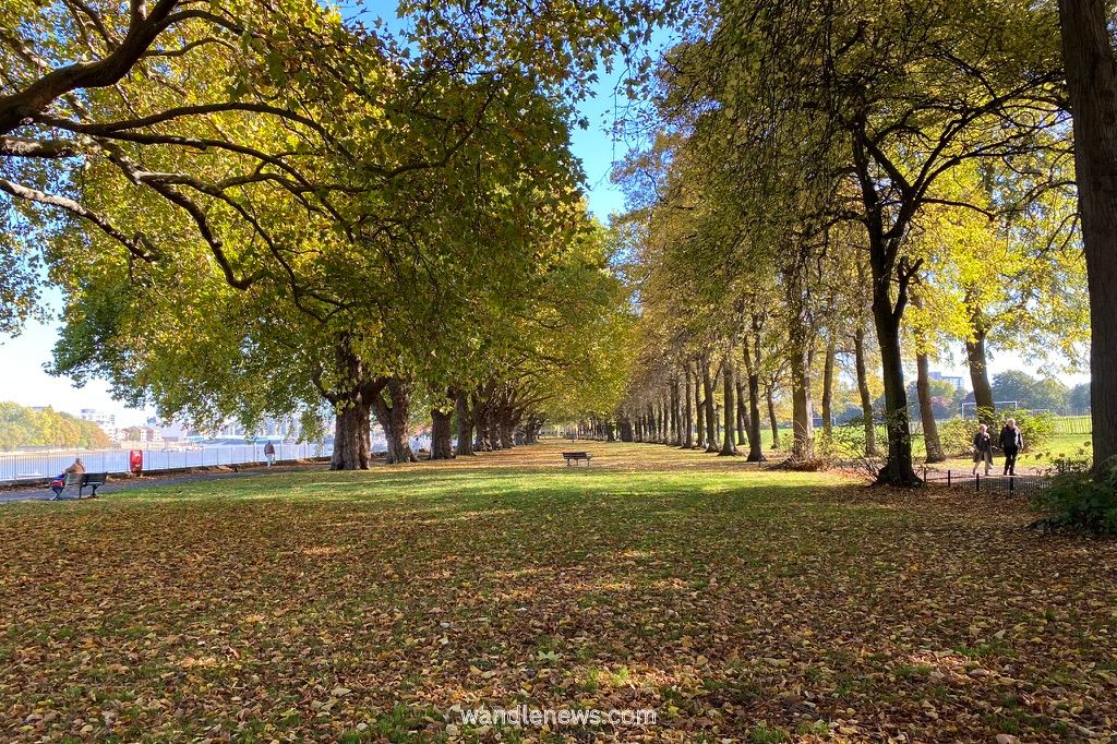
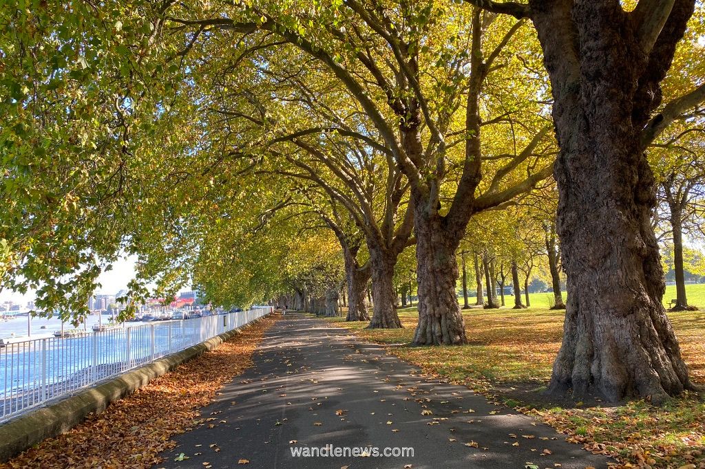
Wandsworth Park
The walk starts in Wandsworth Park.
Wandsworth Park has a beautiful avenue of large London Plane trees along the river path, as well as a double avenue of Lime trees. These trees were planted when Wandsworth Park was created in 1903, and are now over 100 years old.
The park also contains some unusual trees. They include an Indian Bean Tree, which has large leaves and long bean-like seed pods, and an evergreen Strawberry Tree which has strawberry-like red fruits.
After leaving Wandsworth Park, you pass through the Riverside Quarter, which takes you away from the riverside path temporarily.

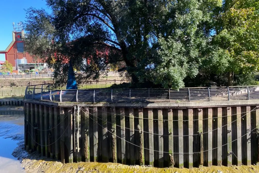
The Spit / The Causeway
The Spit is a nature reserve which is accessible via a wooden footbridge. It was created to attract birds to the area, and contains a number of different shrubs and trees. You will also find a blue sculpture here, which shows a sail on one side, and fish tail on the other.
On the other side of The Spit is the Causeway. The Causeway was once the road from the village square at the end of Wandsworth Plain to the warehouses by the Thames. A water mill once stood here until it was demolished in 1892. This is also the point at which the River Wandle meets the Thames.
After passing The Spit, the path diverts away from the river again. The route is signposted along Smugglers Way, and around the waste facilities. You rejoin the river path again via Waterside Path.

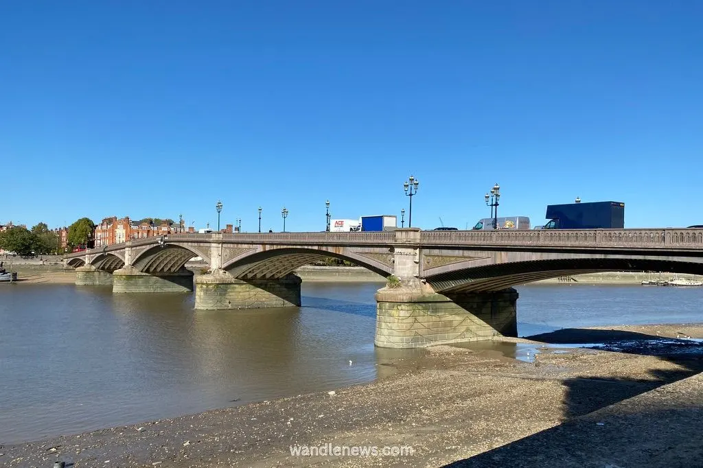
Wandsworth Bridge
Wandsworth bridge is not an ostentatious bridge, but has an interesting history. It was first built in 1873, but failed to generate enough toll revenue to cover its running costs. Like all other privately owned bridges in London, it was taken over by London County Council.
By the 1930s, Wandsworth Bridge could no longer take the weight of traffic, and needed to be entirely rebuilt. It was finally opened again in 1940 during the height of the German air raids on London. For this reason, the bridge was painted different shades of blue, to camouflage it with the river Thames.
The bridge was refurbished in 2020, and still remains blue. It is one of the few structures in London that was built during the second world war.


Tidal Planting Project
The Tidal Planting Project reintroduced native plant species back to the River Thames. The project involved cutting the river wall back by 10 metres, reinforcing the river bank, and creating a graded landscape, so the plants wouldn’t be covered at high tide.
The plants were first introduced in 2005. Today they attract a variety of wildlife, including Black Redstarts, which are small black and red birds that love the rubble on the landscape.


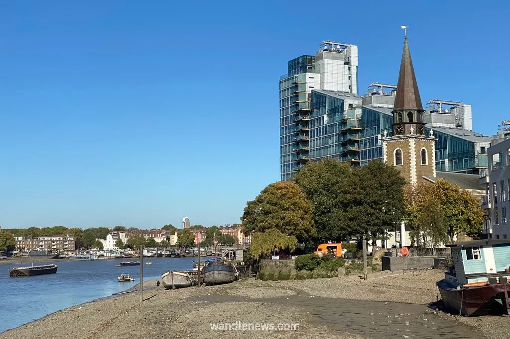
St Mary’s Church
St Mary’s Church in Battersea is one of the earliest documented Christian sites in London. The original church was built around 800AD, and the current building dates back to 1777.
Many famous people are associated with the church, including William Blake who was married here in 1782. The artist J. M. W. Turner, also regularly painted from the grounds of the church.
Turner’s painting titled “Battersea Church and Bridge, with Chelsea Beyond” shows what the church looked like shortly after it opened.

Battersea Bridge
Battersea Bridge was built on a sharp bend in the river. For this reason it is a hazard to boats, and has been closed many times due to collisions.
Out of all of the bridges in London, Battersea Bridge is the narrowest, and also one of the least busy. It was designed by Joseph Bazalgette, who also designed Albert Bridge and Putney Bridge.

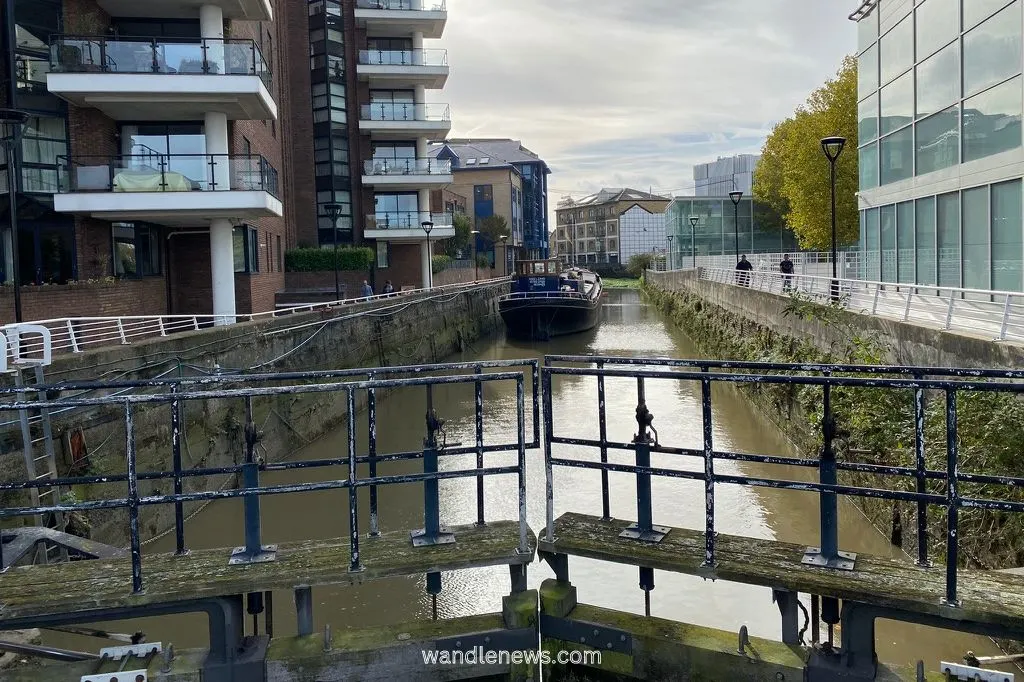
Ransome’s Dock
Ransome’s Dock is the only dock on the River Thames that remains the same size and shape as it was in Victorian times. The dock was cut into the bank of the Thames in 1884 by Allen Ransome, who owned a famous Ipswich-based engineering company.
The dock was designed to take barges and coastal steamers, and was wide and deep enough to allow ships to turn, and to leave on low tide. Today the dock contains office buildings and a block of flats. The Nutbourne restaurant can be found at the far end.

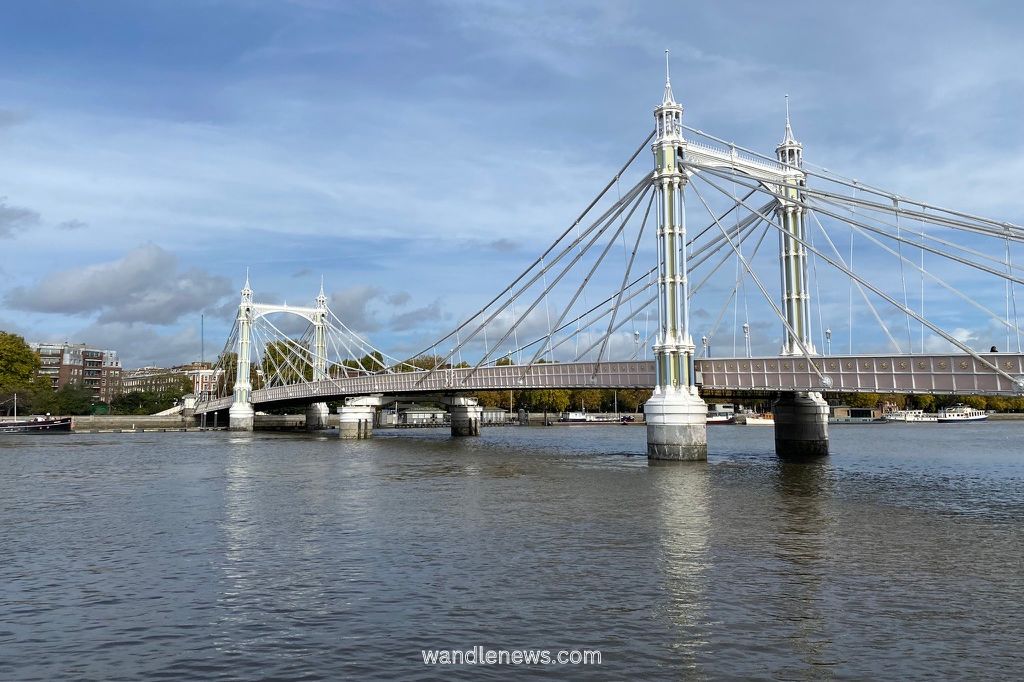
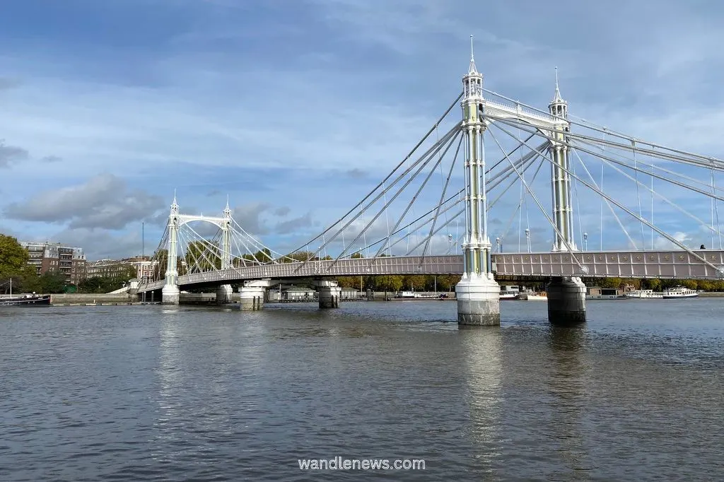
Albert Bridge
Albert Bridge was built in 1873, as a combination of a suspension bridge and a cable-stayed bridge. It was originally painted brown and yellow, but for most of the 20th century it was green, going white and blue for a few decades.
Today, to make it more visible in the fog, and prevent ships from colliding with it, Albert Bridge is painted pink, blue and green. The bridge’s cables are covered with 4,000 halogen light bulbs which, at night time, leave it bathed in light.
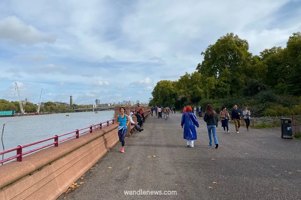
Battersea Park
The stretch of the river path that goes through Battersea Park is part of The Sri Chinony Peace Mile. It was created in 1986 to give runners the opportunity to run a measured mile along the River Thames. For this reason you will often see joggers along this part of the riverside path.
This part of the walk was once marshland where lavender and asparagus grew. It has good views of both Albert Bridge, and Chelsea Bridge.

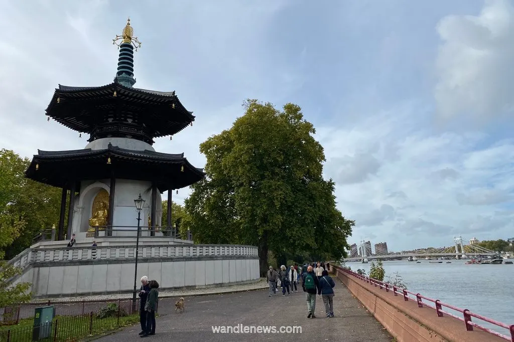
London Peace Pagoda
The London Peace Pagoda can be found along The Sri Chinony Peace Mile in Battersea Park. It was presented to London by the founder of the Japanese Buddhist movement, and built in 1985.
The pagoda is cared for by a single Buddhist monk, Reverend Gyoro Nagase, who lives in the park, near the Old English Garden.
Reverend Gyoro Nagase walks to the pagoda every morning from his temple, gently beating a drum as he goes. He spends his days cleaning the pagoda with volunteers.
On 9 August every year, a floating lantern ceremony takes place in front of the pagoda, to mark the anniversary of the Nagasaki atomic bomb.

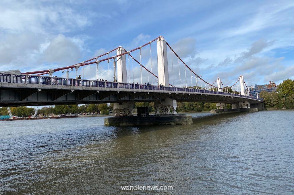
Chelsea Bridge
Chelsea Bridge is believed to be the site where Julius Caesar crossed the River Thames, in 54BC. When the bridge was being built in the 1850s, a number of artefacts were found here, including weapons, skeletons, and the Battersea shield.

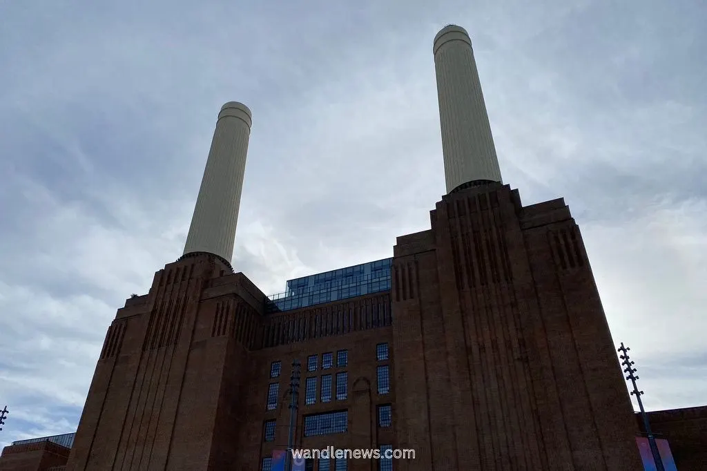
Battersea Power Station
The walk ends at Battersea Power Station. The power station was purposefully built on the banks of the River Thames, as it relied on the river both for water, and to receive coal from ships.
The Thames used to provide 340 million gallons of water each day to the power station, as well as 240 tonnes of coal an hour that was brought in by ship.
The coal was burnt in furnaces in the central boiler house to produce steam to power giant turbines. Excess heat was then pumped underneath the Thames to heat nearby homes.
The iconic Grade II listed building now contains a mixture of shops, bars and restaurants.

How to Get to the Start of the Walk
East Putney station or Putney Bridge tube station are both walking distance to Wandsworth Park, which is the start of the walk.
When you get to the end of the walk, Battersea Power Station tube station is only a short distance away. This station is on the northern line and can take you into central London.
FAQs
How far is it from Putney Bridge to Battersea Power Station?
The walk from Putney Bridge to Battersea Power Station is 5 miles.
Are there public toilets on this path?
Yes. There are public toilets in Battersea Park and at Battersea Power Station.
Other London River Walks
Thames Path From Putney to Battersea
Thank you for reading my post about the Thames Path from Putney to Battersea. If you have taken this walk, please leave me a comment below and let me know what you thoughts.
DougP
Friday 16th of August 2024
Your excellent article has inspired us to take the walk during our short stay in Wimbledon next month. Well done. Doug and Penny (Victoria, B.C.)