
If you have walked along the Wandle Trail in Wandsworth, you may have noticed the small wall that runs down the river in Earlsfield. The wall is visible from Riverdale Drive, or the bridges on Penwith Road, and Duntshill Road. This post explains why the wall was built.

Thanks to Mick from the Wandle Industrial Museum, and Leon Malhomme de la Roche from The Sawmills who helped with this article.
Why is There a Small Wall in the River Wandle in Earlsfield?
The small wall down the middle of the river is the remains of a cofferdam which was built in around 1960, as part of a flood control scheme.
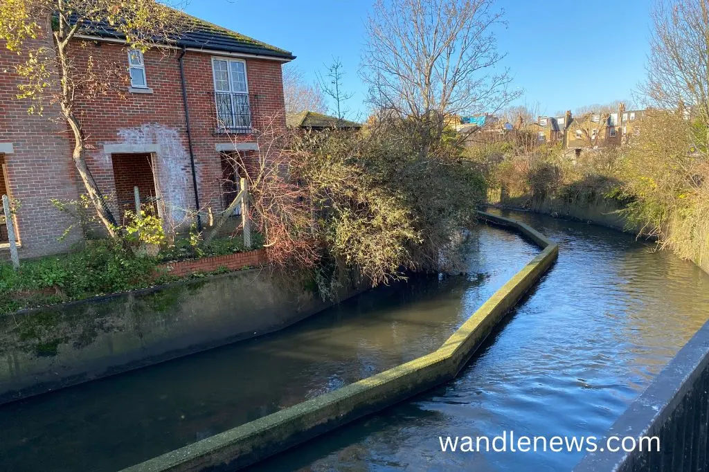
If you haven’t noticed it, the photograph below shows the wall as it passes under the bridge on Penwith Road in Earlsfield.


Why Was a Cofferdam Built in Earlsfield?
The part of the River Wandle that flows through Earlsfield was always prone to flooding. To solve this problem the old London County Council decided to lower the riverbed at this point, to increase the capacity of the river.
In order to do this, construction equipment needed to be lowered onto the riverbed, which required the riverbed to be dry. The only way to achieve this was to build a cofferdam.
A cofferdam is an enclosure built within a river that is completely watertight, so that water can be pumped out of it.
Since the river Wandle still needed to keep flowing, two channels were created down the middle, divided by a small wall. One channel allowed the river to flow through it, while the other was closed off at both ends, and the water pumped out.
Once the water had been drained from the first channel, the riverbed was dug out, and the walls were reinforced with concrete. When this was complete, the river was allowed to flow through the first channel, while the same work was carried out on the other half of the riverbed.
When the construction was was finished, the river was allowed to flow through both channels again, but the wall down the middle of the river was never removed.
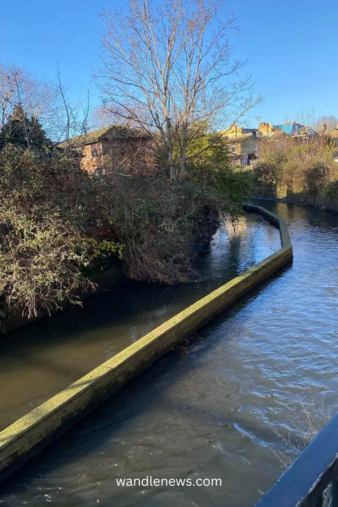
The picture below shows where one end of the wall finishes. The photograph was taken on the small bridge between Riverdale Drive and Flock Mill Place.


How Far Does the Small Wall Stretch?
The concrete-lined channel runs from the south end of Groton Road to Flock Mill Place. The photograph below was taken from the bridge on Penwith Road, looking upstream.


Does the Small Wall Have Any Purpose Today?
The wall itself doesn’t do anything to prevent flooding. It’s simply the remains of construction work that took place in the 1960s. The Environment Agency have advised they are happy for the wall to be removed from the Wandle, but this would be a considerable job to do.

Further Information About the River Wandle
- Why is the River Wandle called Wandle?
- Can You Swim in the River Wandle?
- What are the Numbered Waymarkers Along the Wandle Trail?
- Is the River Wandle Clean?
- Information About Chalk Streams
If you have any further information to add to this article about the wall in Earlsfield, or other flood prevention strategies for the Wandle, please leave me a comment below or get in touch by email.