
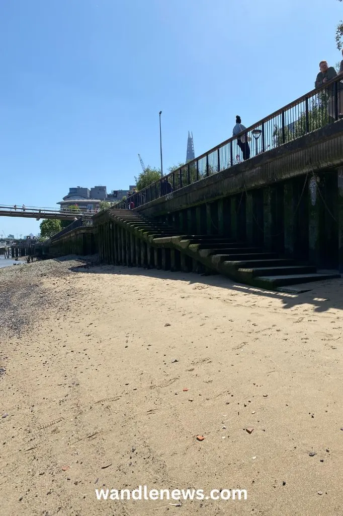
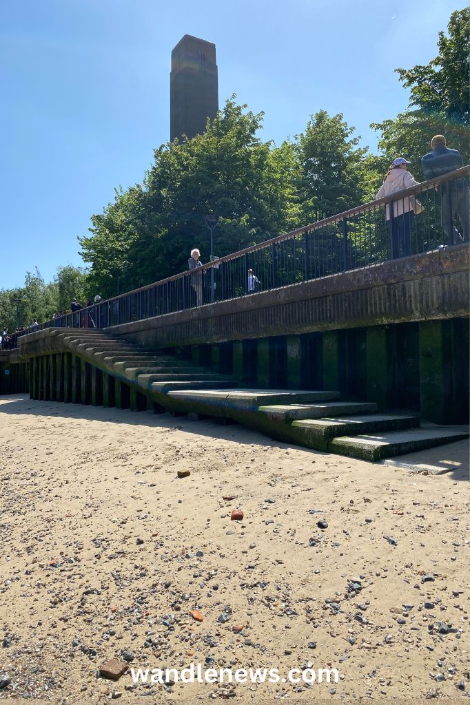
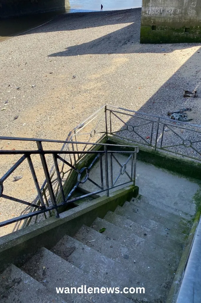
If you’ve just started mudlarking it can be useful to have a list of Thames foreshore access points. This post lists all the best places to access the foreshore of the River Thames at low tide.

When researching this post I checked that all the points mentioned were in areas where you can mudlark with a current foreshore permit. Each place also has either stairs or a ramp that is in good condition.
This post was put together by Wandle News and The Fledgling Mudlark, who identified and photographed many of the access points listed below. Please do not copy or reuse any photographs from this page without permission.
Locations of Thames Foreshore Access Points
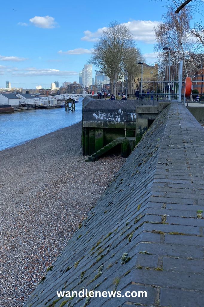
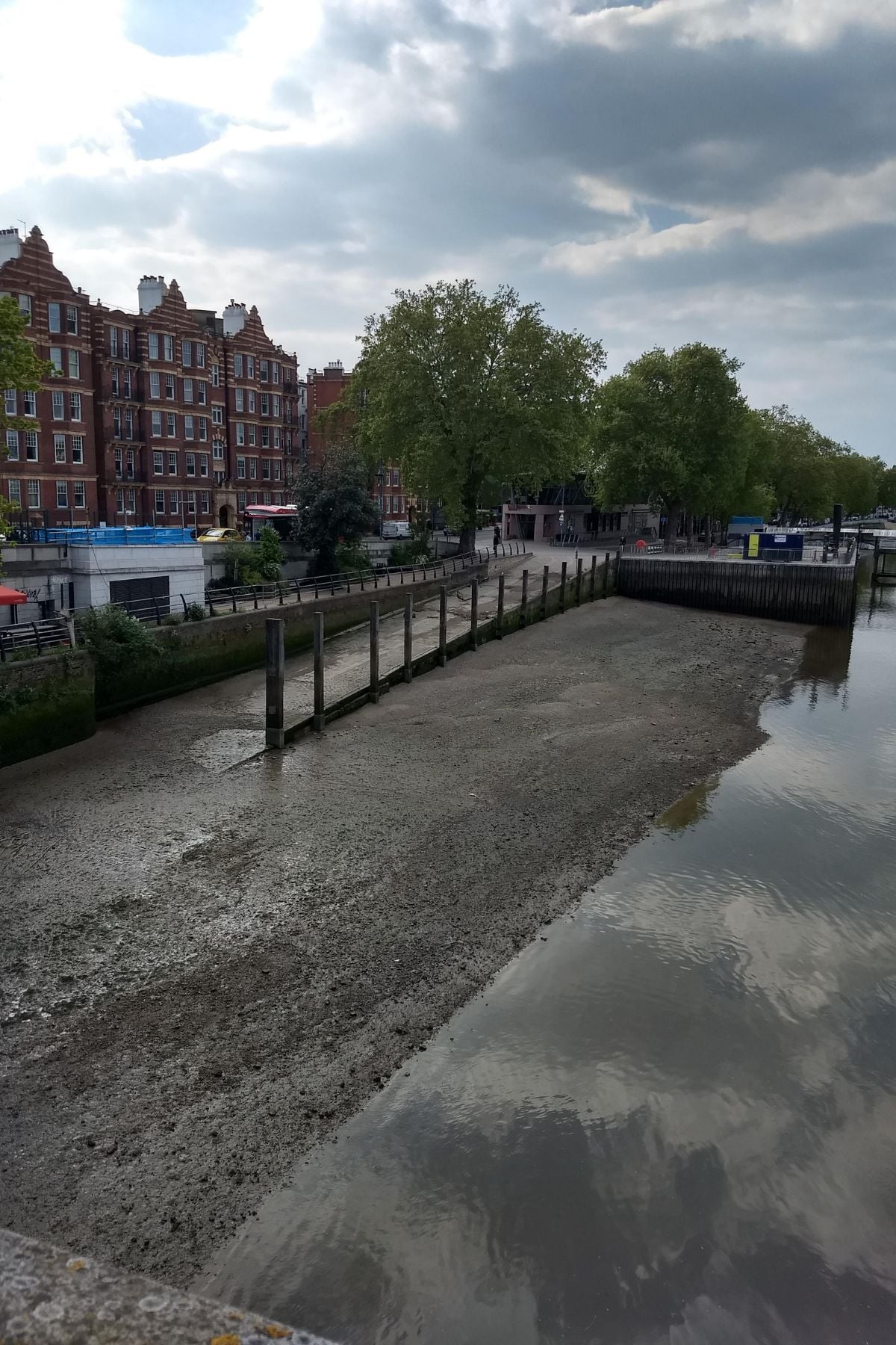
Greenwich
Greenwich is an interesting place to explore the tidal Thames foreshore since it was once home to Greenwich Palace (1498–1694). Most of the objects discovered in Greenwich have some connection with the palace, and the people who lived and worked there.
On the foreshore in Greenwich you can see a line of wooden posts that were thought to have been part of the medieval jetty that once belonged to Greenwich Palace. Many items discovered in the riverbed here have been linked to the palace, including cooking pots, utensils and pottery.
The riverbed in Greenwich is also covered in animal bones, not only from domestic animals like sheep, goats and cows, but also wild animals like deer. Deer antlers and boar tusks have been found in the Thames mud at this point, since during medieval times there was a large park behind Greenwich Palace.
Below are seven access points onto the Thames foreshore in Greenwich.
Thames Foreshore Access Points in Greenwich
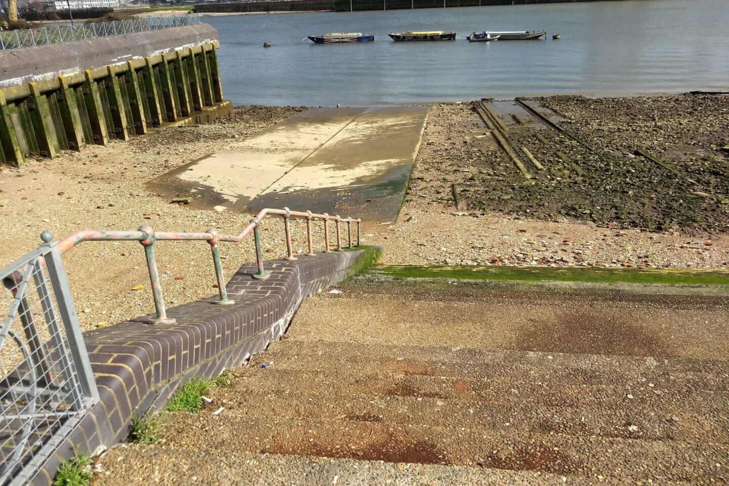
1. Near the Thames Barrier
Location: Riverside, Greenwich, SE7 7SS.
Information: Just up from the Thames Barrier. The steps onto the Thames foreshore are behind the Anchor & Hope pub.
2. Greenwich Yacht Club
Location: 1 Peartree Way, London SE10 0BW. What3Words:///meals.tender.young
Access point: The access point is next to Greenwich Yacht Club. This access point was identified and photographed by The Fledgling Mudlark.

3. Next to the O2
Location: Drawdock Slipway, Olympian Way, Greenwich, SE10 0JH
Access point: Right next to the O2. When we visited, this area was inaccessible due to building work.
4. Enderby’s Wharf
Location: Telegraph Ave, Greenwich, SE10 0TH
Access point: The gate to the stairs was locked when we visited in February 2026.
5. Golden Anchor Stairs
Location: 3 Anchor Iron Wharf, Ballast Quay, London SE10 9GL. What3Words: ///lasts.stage.speeds
Access point: The stairs are on Ballast Quay next to Anchor Iron Wharf. This access point was identified by The Fledgling Mudlark.
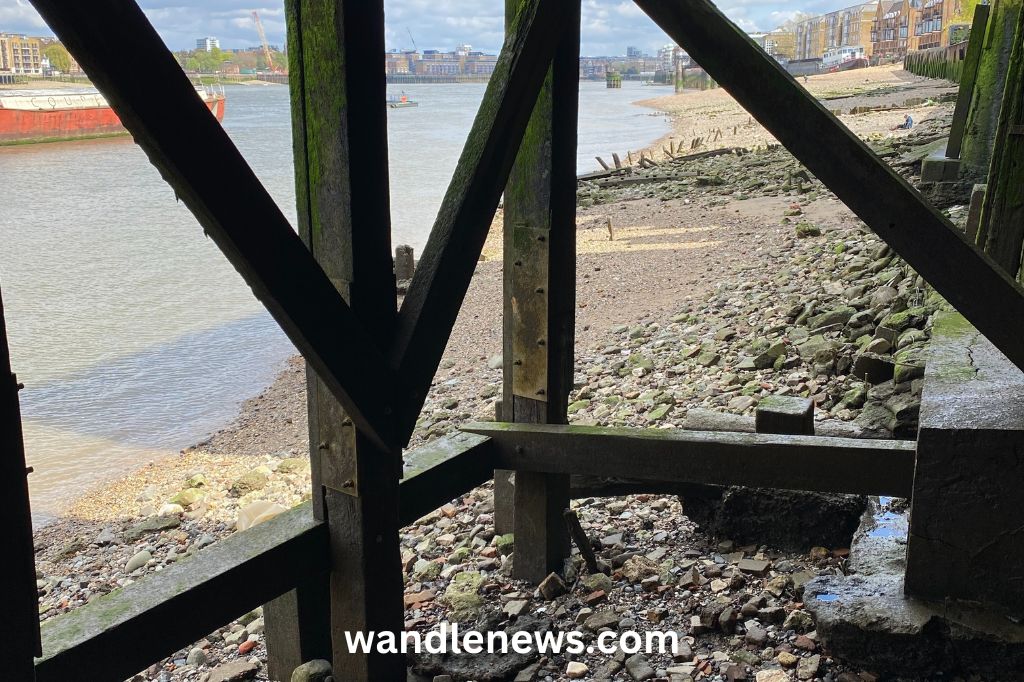
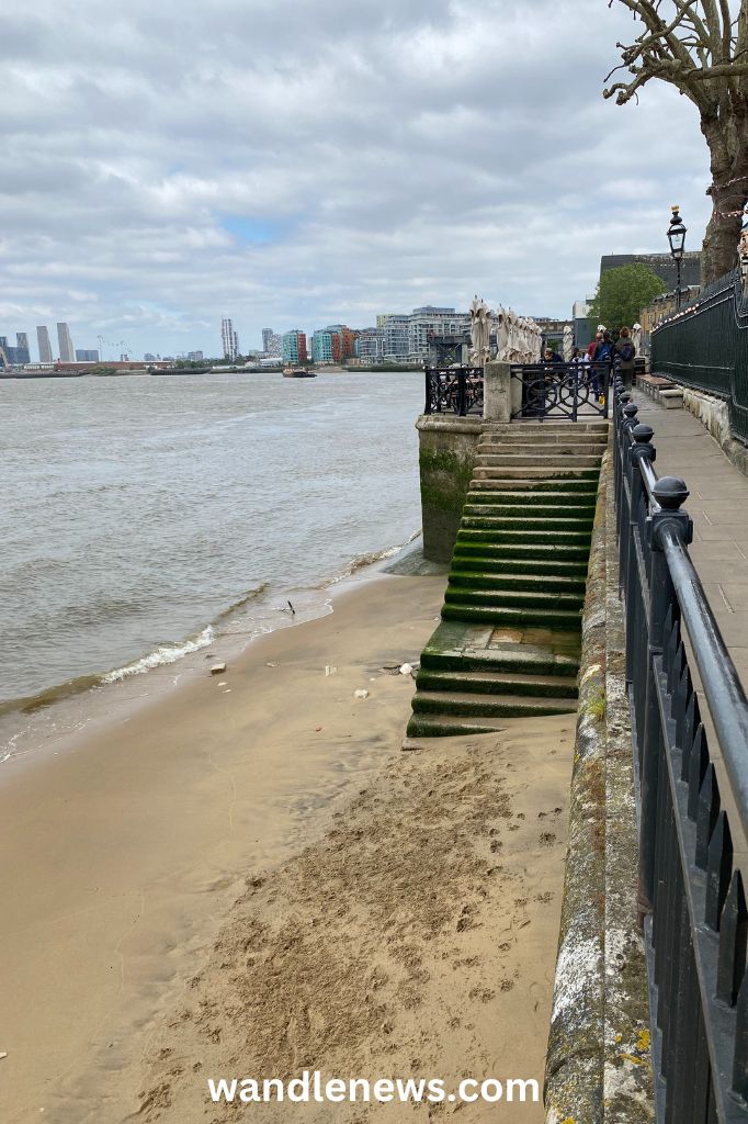
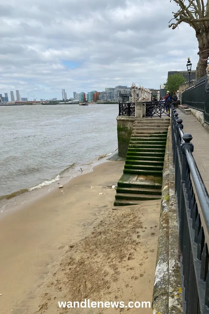
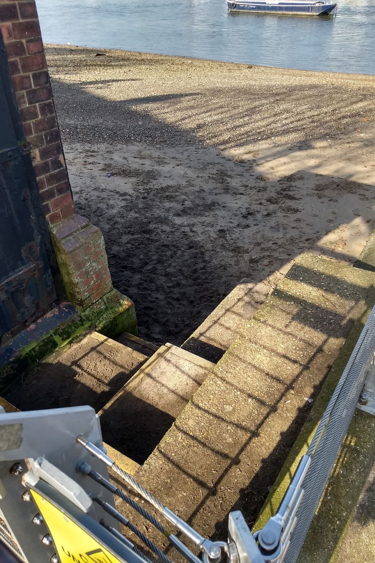
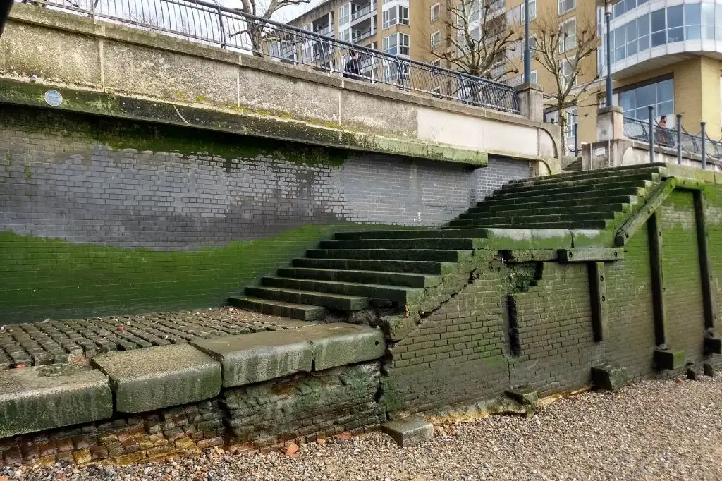
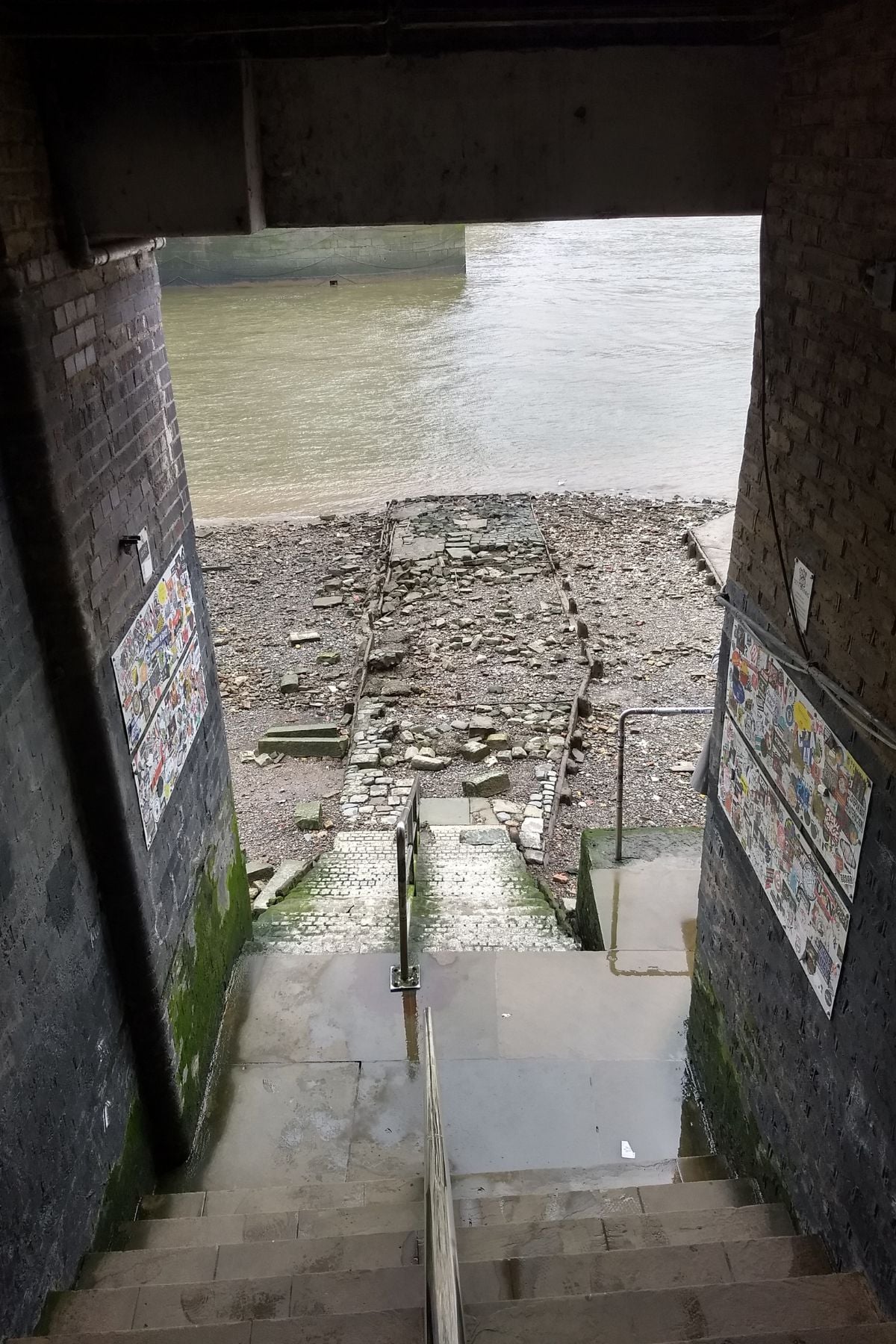
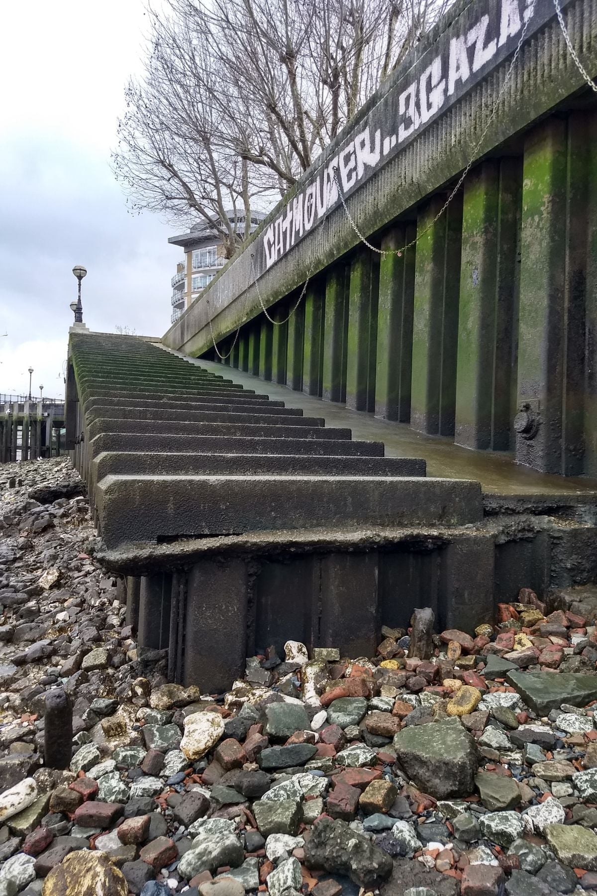
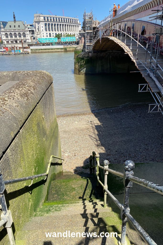
6. Royal Naval College (Royal Steps)
Location: Thames River Path next to the Royal Naval College in Greenwich, SE10 9NN
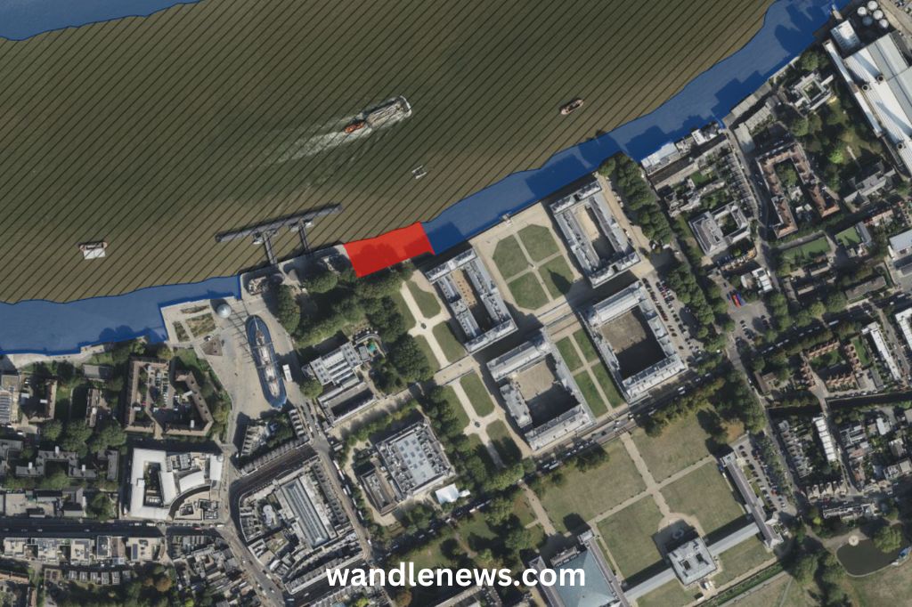
Access point: The steps onto the foreshore are right next to the Royal Naval College. Please note that this access point is very close to a section where mudlarking is not permitted (at the former site of Greenwich Palace). The image below shows the area marked in red where no digging, metal detecting, searching or any other disturbance is allowed.
These stairs are also known as Royal Steps, Queen’s Steps or Watergate Stairs (the names are used interchangeably).

Find out more about accessing Greenwich Beach.
7. Cutty Sark / Billingsgate Dock
Location: London, SE10 9HT (Next to the Cutty Sark along the Thames Path). What3Words: ///pass.reach.broad
Access point: The access point is next to the Cutty Sark. This access point was identified and photographed by The Fledgling Mudlark.
Lewisham
Below are two access points onto the Thames foreshore in Lewisham.
Thames Foreshore Access Points in Lewisham
1. Watergate Street
Location: Watergate Street, Lewisham, SE8 3JF.
Access point: Walk all the way to the end of Watergate Street to find the stairs leading down onto the Thames foreshore.
2. St George’s Square
Location: St Georges Square Lewisham, SE8 3PD
Access point: The stairs are at one end of St George’s Square on Deptford Wharf.
Isle of Dogs
The Isle of Dogs is where metal ships were made in the 19th century. Please note you are not permitted to mudlark on the Great Eastern slipway, as this is a Scheduled Monument.
Below are five access points onto the Thames foreshore on the Isle of Dogs.
Thames Foreshore Access Points on the Isle of Dogs
1. London Yard Drawdock
Location: Amsterdam Rd, London E14 3UU. What3Words: ///added.played.gave
Access point: A drawdock leading down onto the foreshore. This access point was identified and photographed by The Fledgling Mudlark.
2. Newcastle Drawdock
Location: Newcastle Drawdock, Glenaffric Ave, E14 3BW
Access point: There is a very wide access point leading down onto the river bed.
3. Johnson’s Drawdock
Location: Johnson’s Drawdock, Ferry St, Isle of Dogs, E14 3PS
Access point: This location is next to Poplar Rowing Club.
4. Millwall Slipway
Location: 235A Westferry Rd, London E14 3QS. What3Words: ///copy.dwell.report
Access point: A small drawdock next to the Docklands Sailing and Watersports Centre. Please note this access point is not connected to the main stretch of foreshore, and the beach here is small. This access point was identified and photographed by The Fledgling Mudlark.
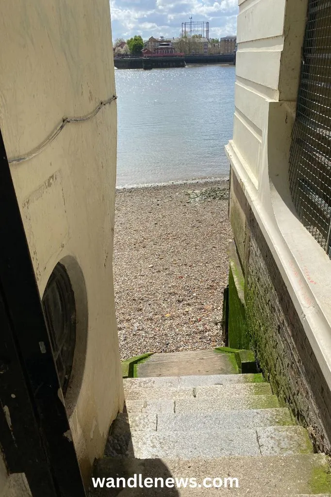
5. Glengall Stairs
Nearest address: New Atlas Wharf, 3 Arnhem Pl, London E14 3S
Access point: The stairs are along the Thames Path directly to the south of Sir John McDougall Gardens. The stairs are eroded in places towards the top of the staircase (shown in the photograph below) but it has a secure handrail all the way down. The beach itself was wide and long. This access point was identified and photographed by The Fledgling Mudlark.

Limehouse
Until the 1950s Limehouse was London’s Chinatown, an area famed for its taverns, opium dens, and cosmopolitan sea faring community.
In the eighteen century it was filled with ships bringing cargo from overseas. Many of the items found here belonged to sailors, and people employed to unload the ships. They include clay pipe stems, glass bottles and everyday objects like buttons and buckles.
Below is an access point onto the Thames foreshore in Limehouse.
Thames Foreshore Access Points in Limehouse
1. Cascades Stairs
Nearest Address: Belgrave Court, 36 Westferry Circus, Canary
Access point: The stairs can be accessed via Three Colt Street. The stairs are in good condition. This access point was identified and photographed by The Fledgling Mudlark.

2. Ratcliff Beach
Location: Ratcliff Beach, Narrow St, E14 8DL
Access point: The stairs are at the end of Narrow Street where it meets with the Thames Path.
Rotherhithe
In the 18th and 19th centuries this part of the river Thames was covered in wharves and docks, and the river was densely packed with boats and ships. Many of the items discovered on the Thames beaches in Rotherhithe provide historical evidence of the merchant ships that once sailed here.
Below are seven access points onto the Thames foreshore in Rotherhithe.
Thames Foreshore Access Points in Rotherhithe
1. Earls Sluice
This point is close to Greenland Dock which is London’s oldest riverside wet dock.
Location: Earls Sluice, Princess Crescent, SE16 7TY
Access point: There are steep steps next to Greenwich Pier
2. Trinity Wharf Stairs
Location: Queen of Denmark Court, London SE16 7TH. What3Words: ///stir.stroke.exact
Access point: The stairs are at Trinity Wharf, near Queen of Denmark Court. This access point was identified by The Fledgling Mudlark.
3. Pageant Crescent
There is a set of rotten wooden stairs at this point which lead to a stone causeway. This is where a boat once ferried people to the north side of the river.
Location: Pageant Crescent, Rotherhithe, E16 5FX.
Access point: The stairs are at the far end of Pageant Crescent next to blocks of flats.
4. Sovereign Crescent
Location: Sovereign Crescent, SE16 5EF
Access point: The stairs are at the far end of Sovereign Crescent.
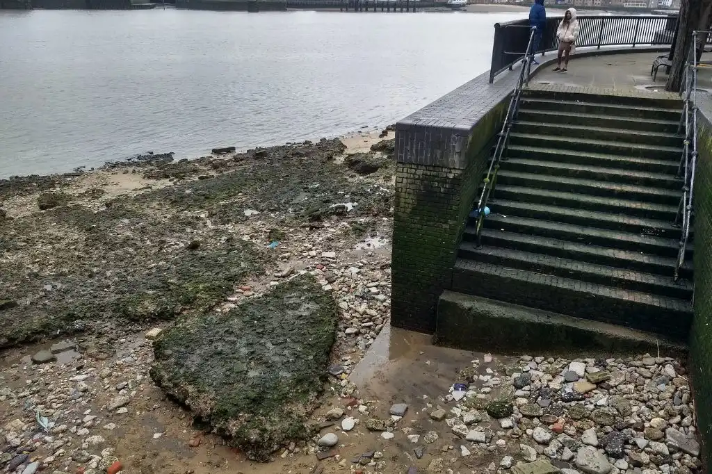
5. Hanover Stairs
Location: Next to 141B Rotherhithe St, SE16 5QT
Access: Hanover Stairs lead down onto Rotherhithe Beach. The stairs are in good condition.
Read more about Rotherhithe Beach

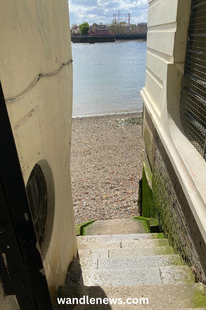
6. The Mayflower Pub
Location: Rotherhithe St, London SE16 4NF
Access point: The staircase is next to the Mayflower pub. At the bottom of the stairs there are wooden beams to climb over to access the foreshore. I recommend walking round to Hanover Stairs as it’s much easier to access Rotherhithe beach from there.

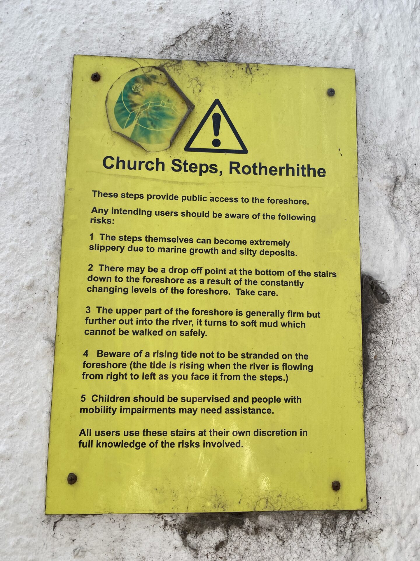

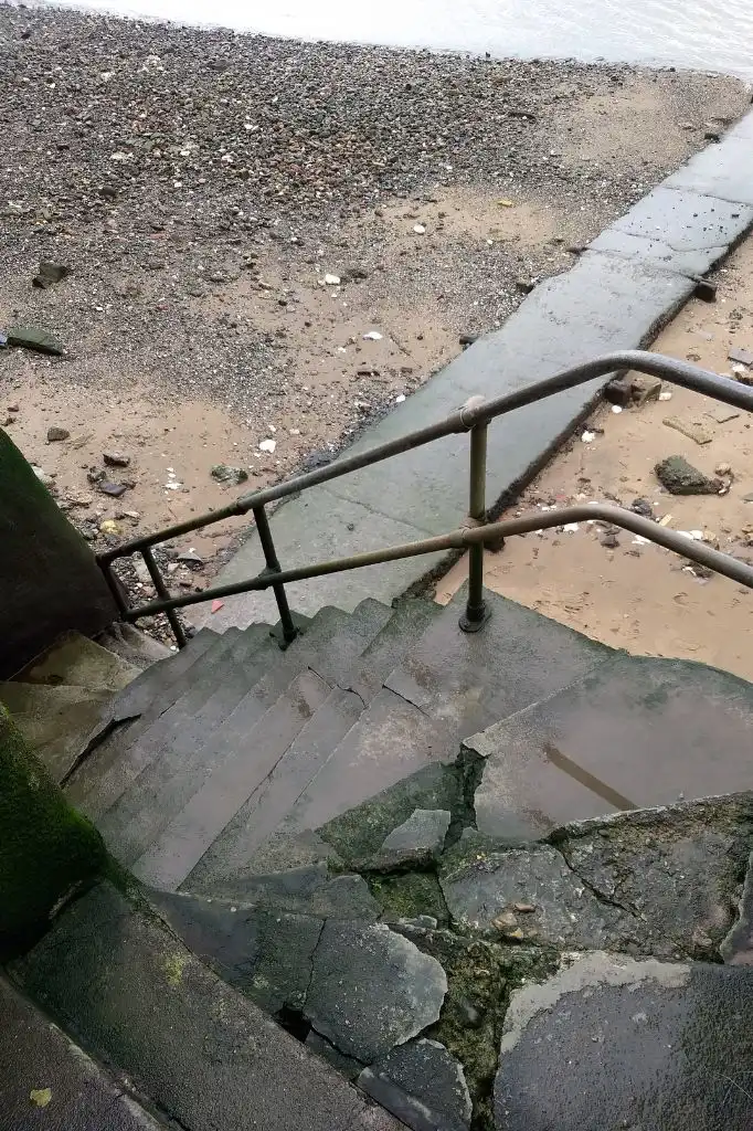
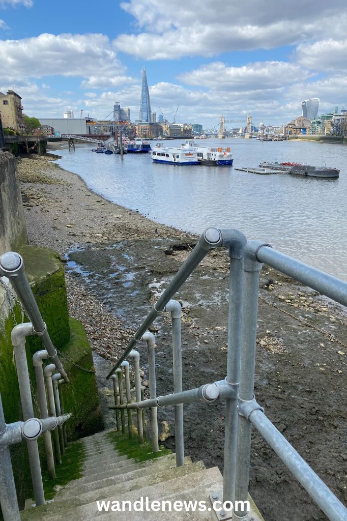
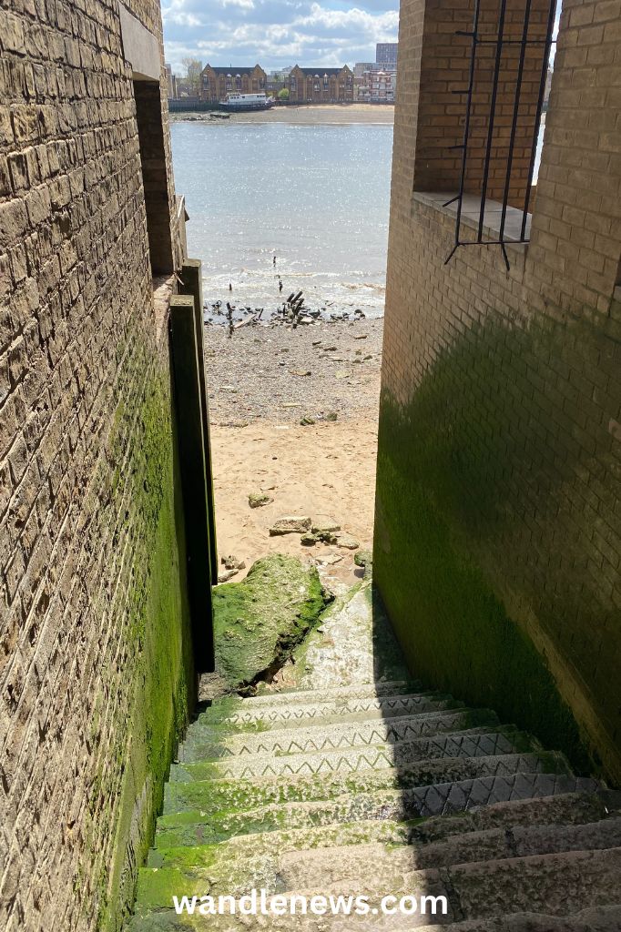
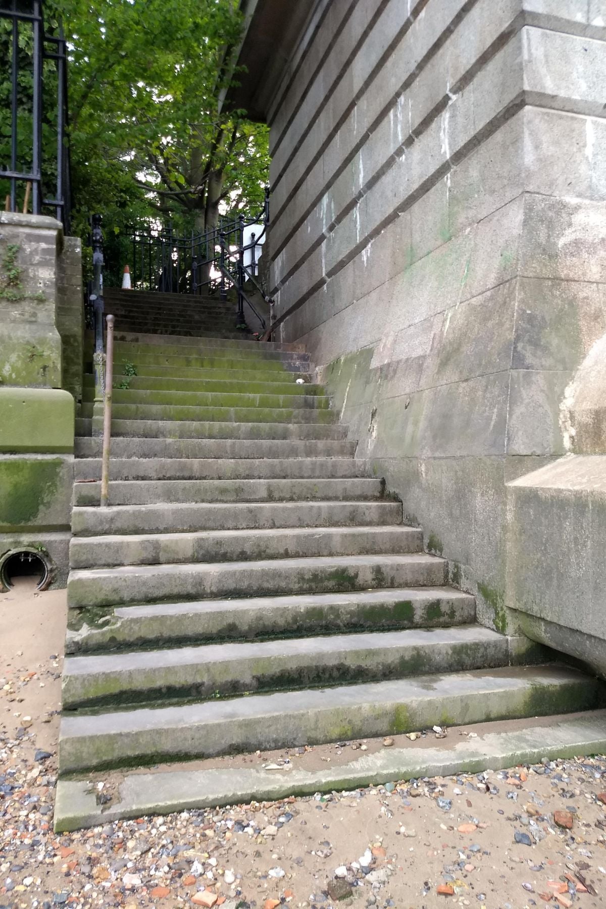
7. The Leaning Tower of Rotherhithe (King’s Stairs)
Location: King’s Stairs, Next to 1 Fulford Street, SE16 4NW
Access Point: These stairs have hand railings on both sides, however the stone at the bottom of the stairs is very slippery. The stairs are found directly next to The Leaning Tower of Rotherhithe.

Wapping
Wapping is directly opposite the Mayflower pub in Rotherhithe. John Rocque’s map of London from 1746 shows that this area was filled with taverns, brothels, wharves, warehouses and narrow alleyways. The map also shows many staircases leading down to the river.
By Victorian times there were 36 taverns on this stretch of the river Thames, but today only 2 of the original taverns still exist: The Prospect of Whitby and the Town of Ramsgate.
Below are three of the old narrow, cobbled passageways onto the Thames foreshore that still exist.
Thames Foreshore Access Points in Wapping
1. Trafalgar Court Stairs
Nearest address: Wapping Wall, London E1W 3TF
Access point: The stairs are along the Thames Path that runs adjacent to Wapping Wall. The stairs are in good condition. This access point was identified and photographed by The Fledgling Mudlark.

2. Prospect of Whitby
Location: Pelican Stairs, Wapping Wall, E1W 3SH.
Access point: The stairs are right next to the Prospect of Whitby pub. There is no handrail but there is a wall on one side.
Read more about the Prospect of Whitby beach.
3. New Crane Stairs
The New Crane Stairs appear on Morgan’s 1682 map of the whole of London.
Location: Near 167 Wapping High Street, E1W 3NQ
Access point: New Crane Stairs are at the end of Wapping High Street where it meets with Garnet Street.
Read more about Wapping Beach.

4. Town of Ramsgate (Old Wapping Stairs)
Location: Wapping Old Stairs East, Wapping High Street, E1W 2PN
Access point: The stairs are right next to the Town of Ramsgate pub

5. Alderman Stairs
Location: 86 St Katharine’s Way, London, E1W 1UR
Access point: Stairs are via narrow alleyway. They are in good condition. This access point was identified and photographed by The Fledgling Mudlark.

Bermondsey
Bermondsey is historically an area of docks and wharves. This area in particular tended to be where ships were made and repaired. Many of the items found here in the river were tools of different craftsmen.
This was also where spice and tea was offloaded from ships into huge warehouses. In the 19th century Bermondsey was an area of crippling poverty, and one of the worst slums in Victorian London.
Below are four access points onto the Thames foreshore in Bermondsey.
Thames Foreshore Access Points in Bermondsey
1. Cherry Garden Stairs
Location: Cherry Garden Pier, Cherry Garden St, London SE16 4TU. What3Words: ///bunks.love.leaps
Access point: The stairs are next to Cherry Garden Pier. This access point was identified by The Fledgling Mudlark.
2. Platform Stairs
Location: 101 Bermondsey Wall E, London SE16 4NB. What3Words: ///minus.tinsel.dive
Access point: The stairs lead down from Bermondsey Wall East. This access point was identified by The Fledgling Mudlark.
3. Bermondsey Beach
Location: Bermondsey Wall East, SE16 4TT
Access point: There are two staircases leading onto the Thames foreshore from Bermondsey Wall East.
Read more about Bermondsey Beach.

4. Horselydown Stairs
Location: 48 Shad Thames, London SE1 2LY. What3Words: ///refuse.damage.voter
Access point: The stairs are on Shad Thames. This access point was identified and photographed by The Fledgling Mudlark.

Southwark
When the Romans first settled in London the south side of the river was a marsh with small islands. They chose one of these small islands for the south side of their bridge, but for centuries this side of the river remained an uninhabited marshland.
Until Westminster Bridge opened in 1750, there was only one bridge linking the south shore with the City of London. This meant the area became isolated from the City, and fell under the authority of the Bishops of Winchester whose palace was on the south side of the river.
The Bishops of Winchester permitted activities that were forbidden in the City of London. This lead to the south side of the river being filled with brothels, inns, and places to watch cockfighting or bear baiting. Many items found in the river mud in Southwark were remains of these infamous inns.
Below are five access points onto the Thames foreshore in Southwark.
Thames Foreshore Access Points in Southwark
1. Southwark Bridge Upstream
Location: Opposite Riverside House (Zizzi), Southwark Bridge Rd, London SE1 9HA. What3Words: ///fans.faster.shops
Access point: The stairs are opposite Riverside House. Please note there is no handrail. This access point was identified and photographed by The Fledgling Mudlark.
2. Emerson Street Stairs
Location: Opposite Shakespeare’s Globe, 21 New Globe Walk, London SE1 9DT. What3Words: ///entire.cost.lies
Access point: The bottom step of the staircase is missing so it is a bit of a jump up, but the stairs are well used and accessible. This access point was identified and photographed by The Fledgling Mudlark.
3. Bankside Beach
Location: Founders Arms, Southwark, SE1 9JH
Access point: There are two sets of stairs close to each other. One set of stairs is outside the Founders Arms pub, and the other is further towards Millennium Bridge.
Read more about Bankside Beach.


4. Blackfriars Bridge
Location: Blackfriars Bridge on the south side of the river
Access point: There are two sets of stairs by Blackfriars Bridge. One is located directly to the right of the road bridge and the other is to the left.


5. Oxo Tower
Location: Oxo tower Wharf, Queens Walk, Southwark, SE1 9GY
Access point: The stairs are on the riverside path in front of the Oxo Tower.

Lambeth
Below are two access points onto the Thames foreshore in Lambeth.
Thames Foreshore Access Points in Lambeth
1. Gabriel’s Wharf
Location: Gabriel’s Wharf, Upper Ground, London SE1 9PP
Access point: The stairs to the west of the Oxo Tower, near the Southbank Observation Point.

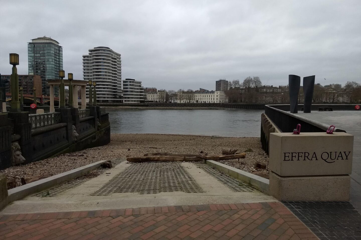
2. Lacks Dock / Effra Quay
Location: Albert Embankment, London SE1 7TP. What3Words: ///sailor.label.bounty
Access point: A wide, easily accessible entry point near Vauxhall Bridge. Lacks Dock was the historical landing point for visitors to the Vauxhall Pleasure Gardens in the 17th century, and has recently been renamed Effra Quay after the River Effra, one of London’s lost rivers that once joined the Thames here. This access point was identified and photographed by The Fledgling Mudlark.
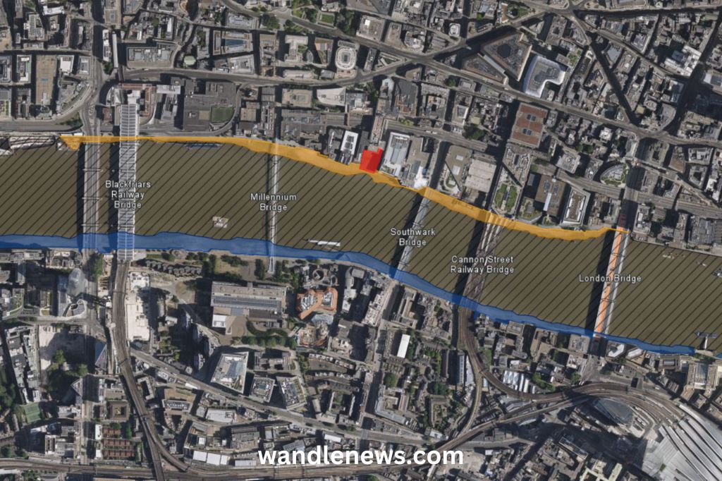
The City
Please note that the north side of the Thames has some restrictions at this point. This area is marked in yellow on the image below. If you are mudlarking here you can use your eyes only. Digging or any surface disruption is not permitted. No mudlarking is permitted at all near Queenhithe Dock, marked in red below.
Thames Foreshore Access Points in the City
1. London Bridge
The Romans built the first crossing over the river Thames around 2,000 years ago about 20 yards downstream from where London Bridge is today. This is the most likely place on the Thames to discover Roman artefacts.
When the original bridge was dismantled in 1831, hundreds of Roman artefacts were unearthed in the river mud. This included metal statues of Roman deities, brooches, pottery, rings, Roman coins, weapons and tools.
There are also lots of oyster shells on the riverbed at this point. This is because oysters were a major food source in Victorian London, and the shells were often discarded into the river.
Location: Fishmongers Hall Wharf, EC4R 9EL
Access point: The stairs are on the same side of the bridge as Fishmongers Hall. This section of the foreshore has restrictions. All surface disturbance and digging is prohibited.
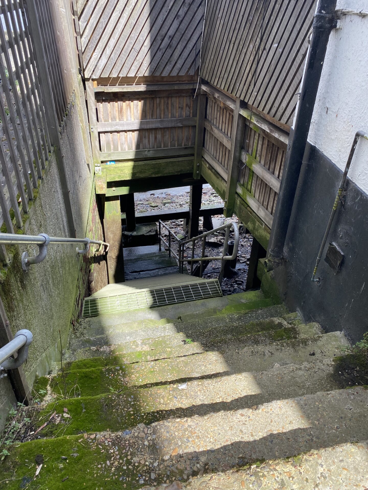
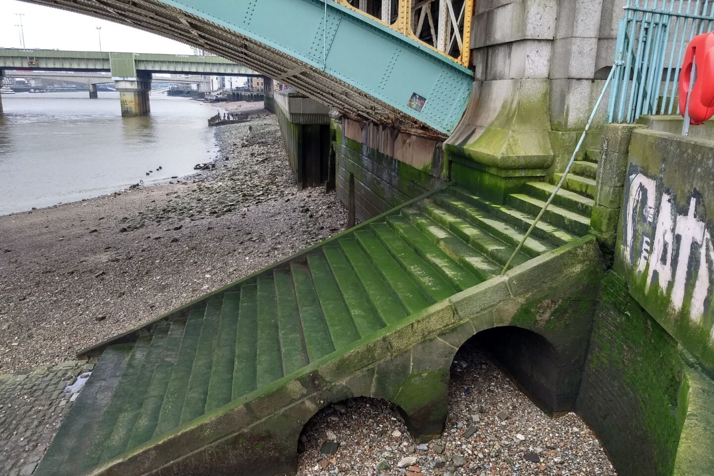
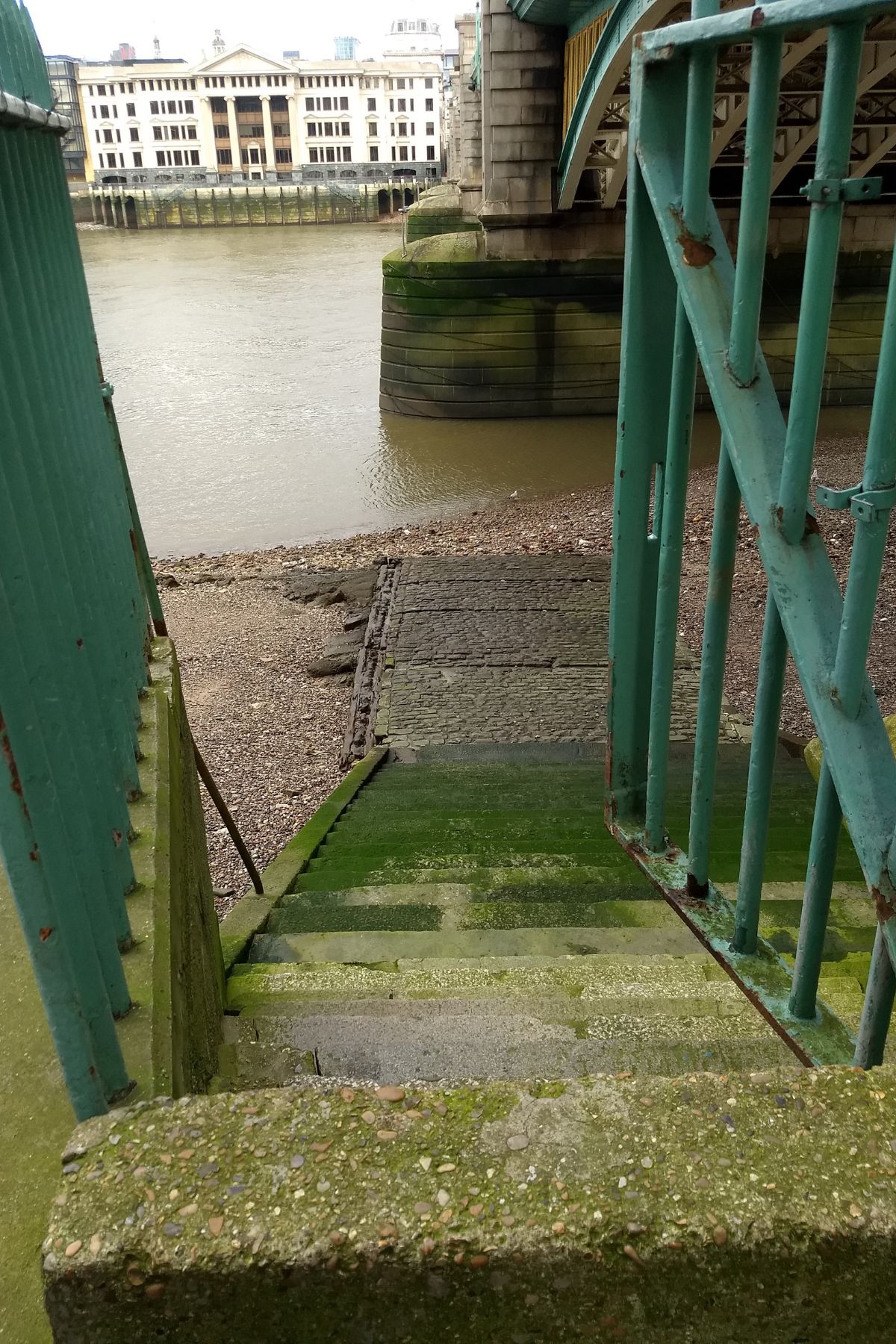
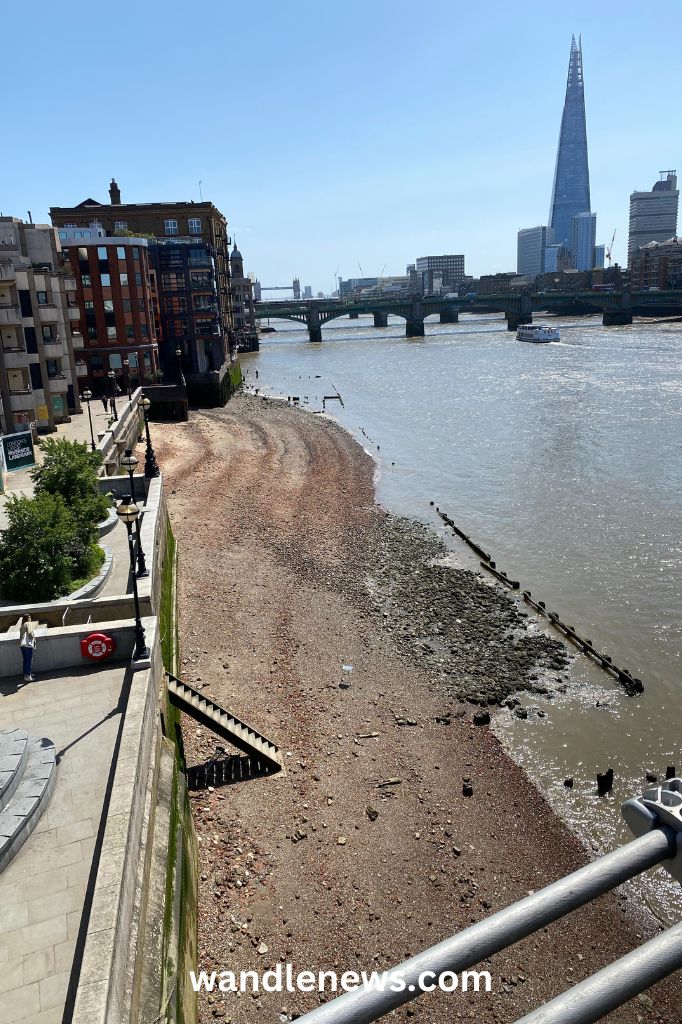
2. Millennium Bridge (Trig Lane Stairs)
The stairs on the east side of Millennium Bridge are where Trig Lane once existed. For this reason they are known as Trig Stairs. At the bottom of the stairs you can see the original Victorian steps that would have led down to the riverbed.
Over the centuries the river Thames has narrowed, and in medieval times the riverfront was around 50 feet further inland from where it is today. In the 1970s the remains of some medieval river stairs were discovered by the Museum of London close to this point.
The land levels in the City of London have also risen by roughly one foot every century. This means Roman remains are buried around 20 feet underground, and Victorian remains about 1 foot. Many discoveries have been found at this point including knives, buckles, keys and gold rings.
Read about my mudlarking experience under Millennium Bridge.
Location: Trig Lane Stairs, Paul’s Walk, EC4V
Access point: The stairs down to the foreshore are steep and there is no hand rail.
Westminster
Thames Foreshore Access Points in Westminster
1. Millbank (Thorney Stairs)
Location: Thorney Stairs, near the junction of Millbank and Thorney Street, SW1P
Access point: The location is in between Vauxhall and Lambeth Bridges.
Chelsea
Below are three access points onto the Thames foreshore in Chelsea.
Thames Foreshore Access Points in Chelsea
1. Yorkshire Grey Stairs
Location: Opposite Chelsea Embankment Gardens, after Albert Bridge. What3Words: ///glare.slide.damage
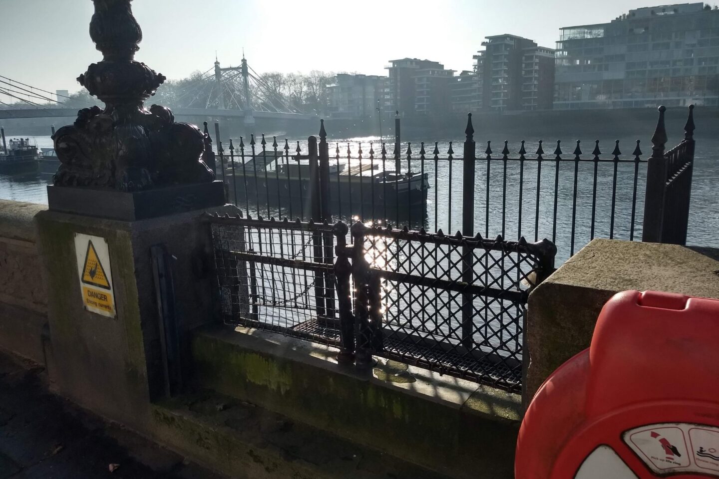
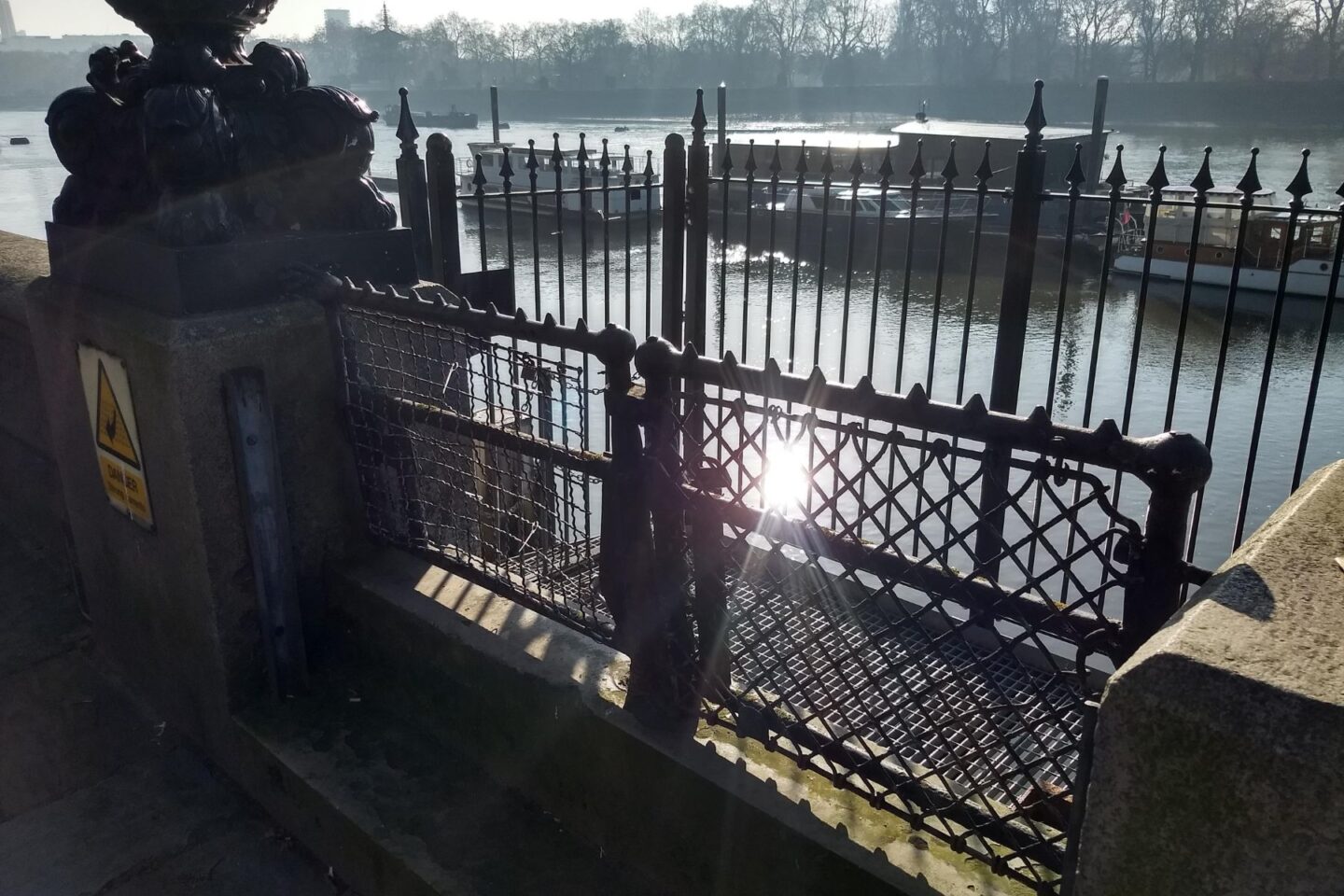
Access point: The stairs are made of metal with a chain handrail all the way down. To reach them you need to step over a low fence (just under 1 metre) from the Thames Path. Please note the gate was locked when we visited in March 2026. Read more about the Chelsea foreshore on The Fledgling Mudlark. This access point was identified and photographed by The Fledgling Mudlark.
2. Cricketers’ Stairs
Location: Eastwards along Cheyne Walk, after Battersea Bridge. What3Words: ///kings.feed.data
Access point: The stairs are made of metal with a chain handrail all the way down. To reach them you need to step over a low fence (just under 1 metre) from the Thames Path, which may cause difficulty for anyone with mobility issues. Read more about the Chelsea foreshore on The Fledgling Mudlark. This access point was identified and photographed by The Fledgling Mudlark.
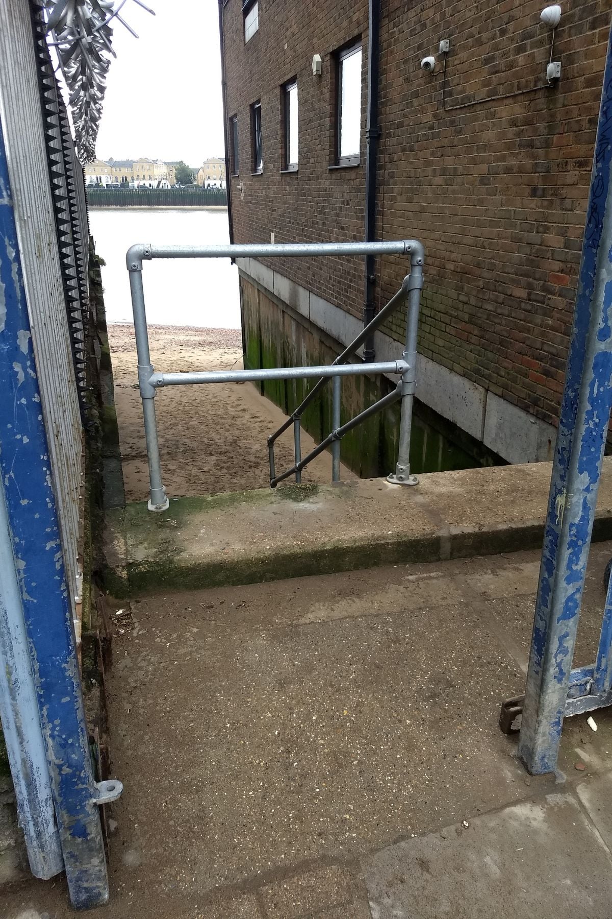
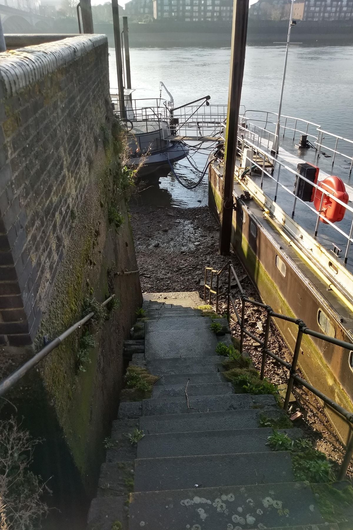
3. Beaufort Stairs
Location: 95 Cheyne Walk, London SW10 0DQ (next to Cheyne Walk Houseboat Moorings). What3Words: ///using.keeps.rally
Access point: The stairs are made of wood and have a handrail. They are located next to houseboats, so please be respectful of residents’ privacy, enter quietly and close the gate behind you. This access point was identified and photographed by The Fledgling Mudlark.
Wandsworth
Below are eight access points onto the Thames foreshore in Wandsworth.
Thames Foreshore Access Points in Wandsworth
1. Battersea Park Upstream
Location: Chelsea Bridge, Nine Elms, London SW11 8NU. What3Words: ///pounds.output.stamp
Access point: The stairs are made of stone and in good condition. They are directly next to Chelsea Bridge, behind a black wrought iron fence. This access point was identified and photographed by The Fledgling Mudlark.
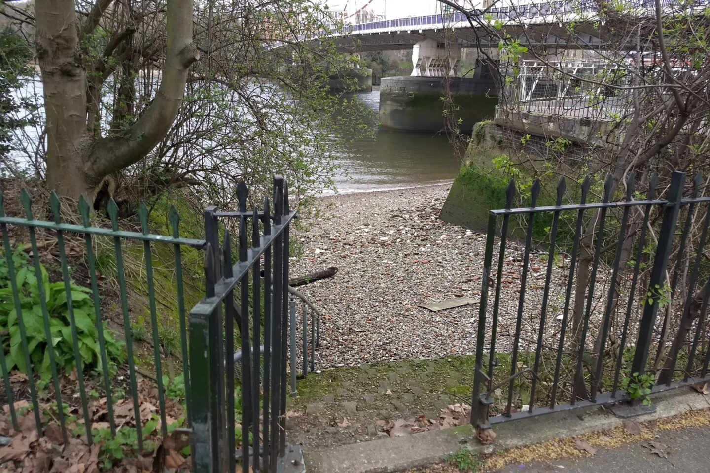
2. Battersea Bridge Upstream
Location: 1 Battersea Bridge, London SW11 3TP. What3Words: ///hope.petty.grabs
Access point: The stairs are on the upstream (west) side of Battersea Bridge. They were cleaner and less slippery than the downstream stairs when we visited.
3. Battersea Bridge Downstream
Location: Battersea Bridge, London, SW11 3BZ. What3Words: ///closed.aura.senior
Access point: The steps are on the east side of the bridge. Please note the stairs and handrail were covered in algae and slippery when we visited (the stairs upstream of the bridge are cleaner).
4. Morgan’s Walk Stairs
Location: Morgan’s Walk (the riverside path between St Mary’s Church and Battersea Bridge), London SW11. What3Words: ///loved.switch.flash
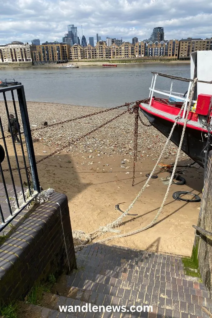
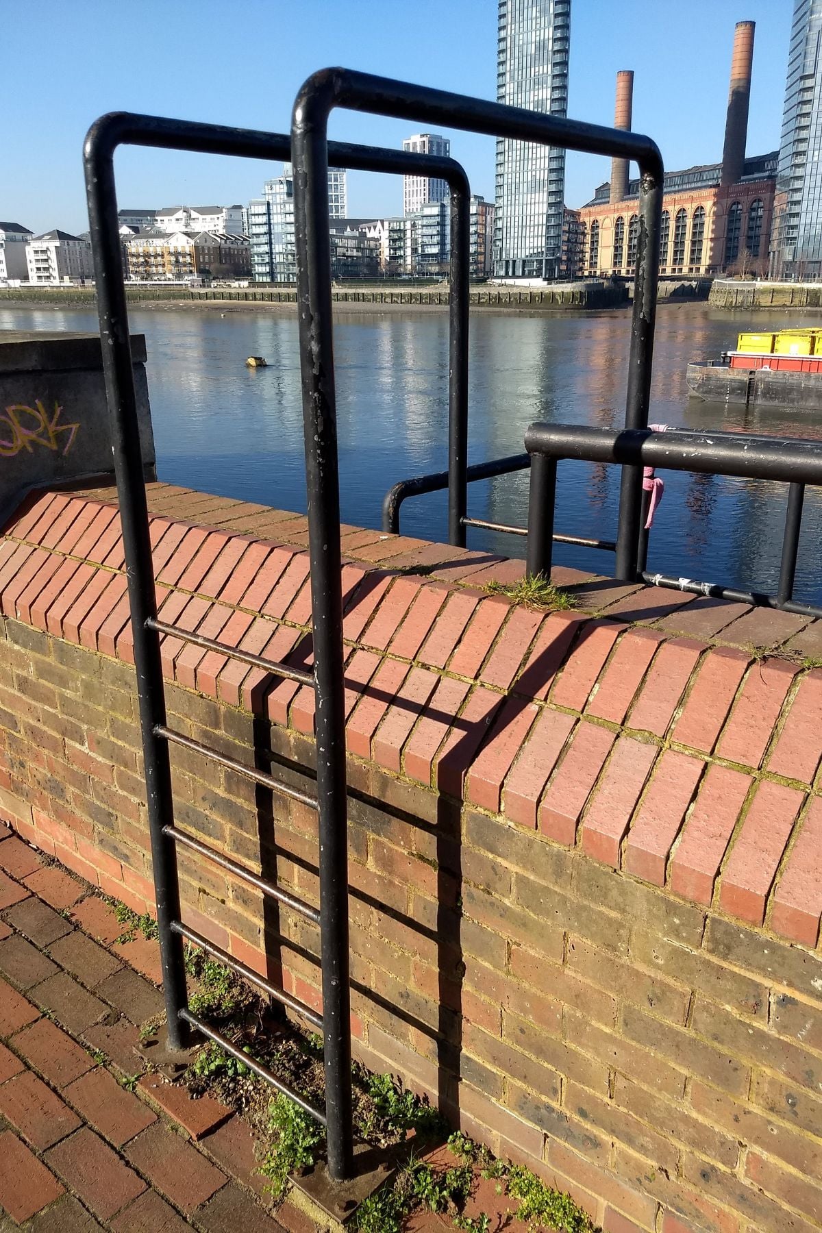
Access point: The stairs are stone, in good condition and have a handrail. However, to reach them you need to climb over the river wall via a short ladder (five rungs each side, with handrails), so they may not be suitable for anyone with mobility challenges. This access point was identified and photographed by The Fledgling Mudlark.

5. Battersea Church Drawdock
Location: Old Swan Wharf, 116 Battersea Church Rd, London SW11 3NA. What3Words: ///scrap.museum.hello
Access point: A very accessible entry point with a gentle sloping ramp onto the foreshore. This access point was identified and photographed by The Fledgling Mudlark.
6. Putney Wharf
Location: Putney Wharf, Brewhouse Lane, SW15 2JX. What3Words: ///spirit.thinks.number
Access point: The ramp is right next to The Boathouse pub.

7. Putney Bridge (Lower Side)
Location: Putney High St, London SW15 1SN. What3Words: ///inspector.offer.tennis
Access point: A stone staircase next to Putney Bridge with a sturdy metal handrail beginning on the first landing down. This access point was identified and photographed by The Fledgling Mudlark.
8. Putney Drawdock
Location: 2-4 Lower Richmond Rd, London SW15 1JN. What3Words: ///older.larger.flat
Access point: A wide, sloping entry path onto the foreshore with no stairs — this is the westernmost of the Putney access points. This access point was identified and photographed by The Fledgling Mudlark.
Map of Thames Foreshore Access Points
All the points I mentioned in this post are plotted on the map below.
Useful Information for Mudlarks
- A Guide to Mudlarking on the River Thames – contains everything you need to know to become a London mudlark.
- 3 Best Mudlarking Books – my favourite book is Mudlarking by Lara Maiklem
- Mudlarking Under Millennium Bridge – this was my experience on a tour with Thames Explorer Trust
- River Thames Foreshore Standard Permit Permissions – this map shows what is allowed with a mudlark permit.
- Thames Tide Times – the Thames is a tidal river so be sure to check the tide times and weather conditions before you go. It’s also always a good idea to be aware of your exit points incase the tide rises quickly.
- Portable Antiquities Scheme – a scheme run by the British Museum to record archaeological finds discovered by the public.
This Post was a List of Thames Foreshore Access Points
I hope this list of Thames foreshore access points was helpful to you. I’m aware that there are many more that I have not listed here. If you know a good place that you think should be listed, please leave a comment below.
Remember to take sensible footwear, like walking boots, if you go for a foreshore walk. The Thames riverbed can be dangerous with sharp objects like pieces of glass, hypodermic needles and other potential hazards.